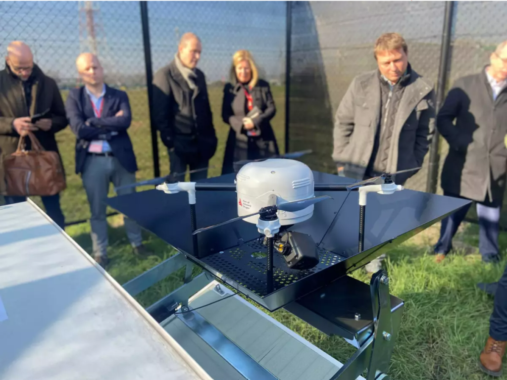
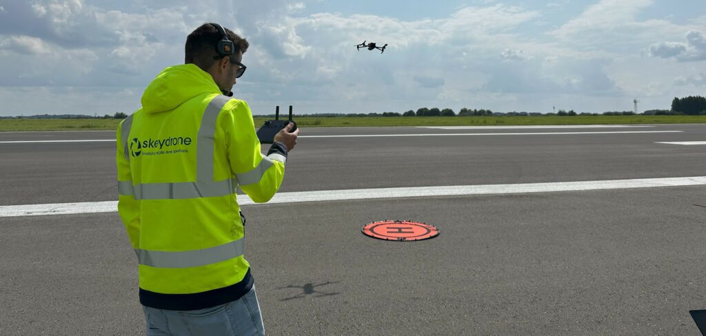
Across Europe, the security landscape for critical infrastructure is changing rapidly. Physical threats are becoming more complex, more frequent, and increasingly technology-driven. In response, the European Union introduced the Critical Entities Resilience (CER) Directive, a major regulatory framework designed to ensure that essential services remain operational, even during serious disruptions.
For operators of critical infrastructure, including airports, energy facilities, ports, government sites, and other essential service providers, this Directive introduces a clear obligation: resilience must be demonstrable, measurable, and continuously improved. And increasingly, resilience means addressing the growing risk posed by drones.
The CER Directive: A New Standard for Infrastructure Resilience
The CER Directive requires EU Member States to strengthen the protection of organisations that provide essential services to society and the economy, such as transport, energy, digital infrastructure, and public safety. By July 2026, countries must identify the entities that qualify as critical. Once designated, these organisations will have ten months to comply with the Directive’s resilience requirements, bringing the likely compliance deadline to May 2027.
Organisations identified as critical entities must then implement appropriate technical, security, and organisational measures to ensure continuity of their essential services.
Drones: A Growing Risk to Critical Infrastructure
Drones are transforming industries, enabling new services and efficiencies. But they also introduce a new category of risk for critical infrastructure. Unauthorised or malicious drone activity can lead to:
Operational disruptions
Safety incidents
Surveillance and intelligence gathering
Delivery of hazardous payloads
Cyberattacks
High-profile incidents at airports, energy facilities, and industrial sites have already demonstrated how a single drone can halt operations or trigger large-scale security responses. For organisations responsible for essential services, the inability to detect and assess drone activity represents a clear resilience gap.
Drone Detection as a Resilience Measure
Under the CER Directive, critical entities must adopt measures that are proportionate to the risks identified in their assessments. For many sectors, the ability to detect and understand drone activity in their airspace will become a fundamental part of their CER compliance strategy.
SkeyDrone’s SiteSecure solution can help critical infrastructure operators to:
Maintain operational continuity during drone incidents
Document and analyse incidents
Our solution integrates seamlessly with different types of detection hardware and with existing security and operational systems, providing organisations with a clear, real-time view of drone activity in their vicinity.
For critical entities preparing for CER compliance, this capability plays an important role in addressing the Directive’s requirement for technical and security measures that ensure operational resilience.
Preparing for the 2027 Compliance Deadline
With Member States currently finalising national strategies and identifying critical entities, organisations should begin evaluating the risks that could disrupt their essential services.
By integrating drone detection into their resilience strategy, critical infrastructure operators can close an emerging security gap while strengthening their ability to maintain operations under all conditions.
Ready to secure your airspace and protect your operations? Discover our SiteSecure solution and learn how we can help you stay ahead of drone threats and ensure operational resilience.
Brussels, 5 March 2026 – SkeyDrone today announces the launch of RunwaySafe, an advanced drone threat assessment solution, purpose-built for airport environments. Developed in close collaboration with airport operations teams and air traffic control, RunwaySafe enables airports to move from simple drone detection to intelligent, risk-based decision-making.
Airports worldwide are facing an increase in drone sightings. Even unverified reports can trigger runway closures, flight delays and costly diversions. Limited situational awareness often makes it difficult to determine when it is safe to resume operations, extending disruption and impacting passenger confidence.
RunwaySafe addresses this challenge by assessing each drone sighting in real time and highlighting only those flights that pose a genuine and immediate risk to airspace safety or airport security.
“Airports cannot afford to close operations every time a drone is detected in controlled airspace,” said Stijn De Vleeschhouwer, Managing Directorat SkeyDrone. “RunwaySafe provides the operational intelligence needed for airports and ANSPs to distinguish between irrelevant drone activity and genuine threats, enabling faster, safer and more proportionate decisions.”
From Detection to Decision Support
Unlike traditional detection systems that generate alerts for every drone entering controlled airspace, RunwaySafe applies aviation-grade operational logic aligned with real-world procedures. The platform visualises drone activity within a dynamic airport environment, automatically adapting to active runway configurations and operational modes.
Key capabilities include:
3D Airport Threat Zones aligned with runways, approach paths and critical operational areas
Advanced Threat Classification to reduce false alarms and unnecessary escalations
ATM and UTM Integration for unified awareness across crewed and uncrewed traffic
Multi-Sensor Integration combining RF, radar, camera and acoustic detection systems
Analytics and Forensics supporting post-incident analysis and compliance reporting
RunwaySafe has been developed in close collaboration with skeyes, one of Europe’s leading ANSPs, in one of the world’s most complex airspaces and is aligned with frameworks and guidance from EASA, ICAO, ACI and IATA. The solution is also fully compliant with the internationally recognised Detection, Identification, Tracking and Threat Assessment (DITTA™) methodology.
By transforming raw detection data into actionable operational insight, RunwaySafe helps airports minimise unnecessary closures, protect passengers and assets, and restore operations with confidence after drone incidents.
Register for our webinar to see RunwaySafe in action.
About SkeyDrone
SkeyDrone operates at the forefront of integrating drones safely into the airspace. We enable airports, air navigation service providers, seaports, and critical infrastructure operators to manage and protect their lower airspace with confidence. By combining cutting-edge technologies for drone detection, flight authorisation, and situational awareness, we help organisations turn complexity into control. Our mission is to make low-level airspace safer, smarter, and more connected; from flight authorisation to real-time drone detection, from operational oversight to intelligent decision-making.
For all pilots, whether flying crewed or uncrewed aircraft, situational awareness is everything. Knowing who else is in the air, and where they are is not a “nice to have”; it is a prerequisite for safe operations.
One year ago, SkeyDrone and SafeSky announced a strategic partnership enabling bidirectional data exchange between both platforms. The collaboration marked an important step towards improving airspace awareness and safety, as the skies become increasingly shared between crewed and uncrewed aircraft.
One Integration, Two Outcomes: Safer Drone Flights and Stronger Site Protection
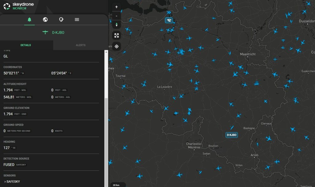
Through this integration, SkeyDrone’s Traffic Information Service has been enriched with real-time in-flight traffic data from the SafeSky platform, including helicopters, gliders, paramotors, paragliders, trikes, and other aircraft. This directly improves situational awareness for drone operators, particularly when conducting missions beyond visual line of sight (BVLOS) and especially in airspace where drones and crewed aircraft operate in close proximity.
In parallel, through the SafeSky UAV API, SkeyDrone’s drone detection solution now also displays drone flights in locations that fall outside the reach of the existing sensor network, including operations across the Dutch and Luxembourg borders. Over the past year alone, this integration has resulted in more than 3,250 additional drone flights being displayed in the SkeyDrone platform, flights that would otherwise have remained unseen.
This expanded coverage is advantageous not only for drone operators flying BVLOS, but also for geozone and security managers utilising SkeyDrone to safeguard their sites from unauthorised drone activity. The SafeSky integration marks significant progress toward achieving comprehensive nationwide drone detection capability in Belgium.
SkeyDrone’s Traffic Information Service enriched with data from SafeSky
Kristof Gilleman
Head of Operations at SkeyDrone
Through this partnership, we support BVLOS drone operators dependent on our Traffic Information Service, while also empowering geozone and security managers who use SkeyDrone to protect critical sites from unauthorised drone activity. The integration with SafeSky represents a major step towards a complete, nationwide aerial picture in Belgium.
Closing an Important Gap: What’s in It for Pilots?
Traditional aviation surveillance systems, such as ADS-B, Mode S, FLARM, were neverdesigned with widespread drone integration in mind. While many professional drone operations today are fully authorised and compliant, yet from a cockpit perspective they may remain non-cooperative. They do not broadcast their position via standard aviation protocols, making them invisible to conventional traffic awareness tools. For VFR pilots operating below controlled airspace, where helicopters, training aircraft, gliders, microlights, and drones increasingly share the same airspace volume, this creates uncertainty. And uncertainty, in aviation, is always a risk factor.
By integrating drone detection outputs from SkeyDrone with the SafeSky APIs, SafeSky can provide live telemetry-based awareness of certain drone operations that would otherwise not appear on traditional aviation displays. And this is not about replacing “see and avoid”; it is about enhancing awareness in an environment where visual acquisition alone is no longer sufficient.
Tristan Fily
CEO at SafeSky
The future of aviation depends on crewed and uncrewed aircraft sharing the sky safely. This partnership with SkeyDrone demonstrates how interoperability can turn that vision into practical awareness for everyday pilots.
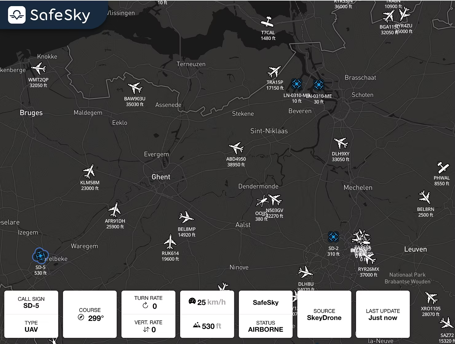
SafeSky displaying drones traffic from SkeyDrone integration
Looking Ahead — A Shared Vision for Connected Airspace
Airspace is evolving. The lower altitudes are becoming more dynamic, more diverse, and more operationally demanding. What used to be a largely homogeneous traffic environment is now a mixed ecosystem of recreational pilots, professional drone operators, emergency services, aerial work missions, and new mobility concepts. In this context, safety increasingly depends on interoperability.
The first year of operational data exchange between SkeyDrone and SafeSky demonstrates that bidirectional interoperability is not only technically feasible: it is operationally valuable. It enables visibility where it was previously limited. It reduces uncertainty where blind spots existed. And it lays the groundwork for a more unified airspace picture.
Belgium may be geographically small, but collaborations like this show how local innovation can have international relevance. By connecting ecosystems rather than competing in isolation, SkeyDrone and SafeSky are contributing to a broader shift in aviation: from fragmented visibility to shared awareness.
Both companies remain committed to expanding this cooperation, embracing cooperative and non-cooperative drone visibility, strengthening interoperability, and working with partners across the aviation and UAS community.
Learn more about SkeyDrone’s Traffic Information Service here.
Steenokkerzeel/Antwerp, 22 January 2026 – SkeyDrone and Unifly have released a major upgrade of their UAS Traffic Management (UTM) platform deployed at the Port of Antwerp-Bruges (PoAB). This new release strengthens operational safety and enhances user experience, further enabling one of the world’s most advanced port-based drone ecosystems.
Building on the strong innovation partnership between SkeyDrone, Unifly, and the Port of Antwerp-Bruges, the upgraded platform enhances capabilities for drone operators, supervisors, and port authorities. It continues the Port’s evolution from pioneering BVLOS trials under the SAFIR project to enabling thousands of drone operations, autonomous sample transport, and scalable industrial drone applications across one of the most drone-progressive ports globally.
PoAB DronePortal
Operational in the Antwerp port area since mid-March 2021, the PoAB DronePortal has enabled safe and compliant drone operations at scale.
Port of Antwerp-Bruges’ drone ecosystem at a glance:
250 registered operators
13,483 operations created
7,665 operations performed
27,621 permission requests approved
2,371 BVLOS operations performed
Overview of the New Capabilities
The update introduces a broad set of new capabilities that enhance safety, useability, and efficiency across the Port of Antwerp-Bruges’ drone ecosystem. Improved airspace information, supported by updated obstacle data, increases situational awareness to support safer drone operations in one of Europe’s busiest and most complex port environments.
A series of user interface and data-management upgrades make the platform more intuitive and reliable, including clearer geozone visualisation, refreshed map layers, more helpful on-screen guidance, simplified explanations of flight rules, updated translations, and cleaner portal visuals. Users also benefit from a rebranded and expanded online help environment offering clearer, always-available guidance, as well as the introduction of Dark Mode for improved usability in a wide range of operational and lighting conditions.
A Platform Ready for the Next Stage of Port-Based Drone Innovation
This release marks another milestone in the Port of Antwerp-Bruges’ digital transformation of its airspace. By enhancing safety, improving situational awareness, and streamlining the operator experience, the UTM platform continues to support innovative drone applications, from industrial inspections to automated logistics, reinforcing PoAB’s position as one of the world’s most advanced ports for operational drone deployment.
To underline Unifly’s long-term commitment to enabling scalable and secure drone operations, Andres Van Swalm, CEO of Unifly, highlighted the significance of the upgrade: “With every release, we help the Port of Antwerp-Bruges unlock new operational efficiencies and safety standards. This upgrade prepares the Port for an increasingly automated future where drones integrate seamlessly into daily operations.”
Stijn De Vleeschhouwer, Managing Director of SkeyDrone, emphasised the value of these improvements for daily users and operational partners across the port: “With this new UTM upgrade, we are raising the bar once again. Users will benefit from a more reliable, intuitive, and efficient system that supports safe and consistent drone operations throughout the port.”
Reflecting on the Port’s ambitions, Didier Venneman, Coordinator Drone Operations at PoAB, emphasises the strategic importance of a future-ready UTM platform in supporting the growth of drone operations: “This upgrade reinforces our leadership in port-based drone innovation. By developing a more user-friendly application, the enhanced platform enables drone operators to plan and monitor missions more intuitively, improving safety and security across the port. It encourages new operators to adopt the system, ensuring compliance with regulations and increasing awareness of potential risks in a complex port environment.”
About SkeyDrone
SkeyDrone is a joint venture between the Belgian Air Navigation Service Provider skeyes and Brussels Airport Company. The company’s mission is to provide end-to-end solutions for all your business needs related to the use of uncrewed aircraft (drones). SkeyDrone offers solutions for lower airspace monitoring, management and protection against drones for authorities and geo-zone managers, UTM/U-space & consultancy services for drone operators and business integration services for companies.
About Unifly
Unifly is a technology company rooted in aviation, dedicated to enabling autonomous aviation by advancing the safety and efficiency of UAS Traffic Management. The Unifly platform connects authorities, drone operators, and stakeholders to digitise and automate airspace management, supporting the safe integration of next-generation aircraft. With the addition of Unifly Consulting, the group combines cutting-edge digital infrastructure with deep regulatory and safety expertise. Offering SORA analyses, regulatory guidance, and operational strategy, Unifly provides a comprehensive ecosystem powering the future of autonomous aviation worldwide.
About Port of Antwerp-Bruges
As Europe’s second-largest seaport, the Port of Antwerp-Bruges is a global hub for trade, industry, and innovation. Through pioneering drone programs and close collaboration with partners such as Unifly and SkeyDrone, the Port is setting new standards for safe and scalable unmanned aviation.
Brussels, 13 January 2026 – SkeyDrone and Airport Intelligence today announced a strategic collaboration to offer international airports a comprehensive, end-to-end approach to drone detection, response, and mitigation of impact.
Airports worldwide are increasingly exposed to drone sightings, posing operational challenges on how to respond and potentially triggering safety and/or security risks. Runway and airport closures triggered by (unverified) drone reports cause massive operational disruption. Delayed flights and diversions result in financial losses and passenger dissatisfaction. Limited situational awareness makes it difficult to decide when it is safe to re-open, often extending closures longer than necessary, resulting in reputational damage.
Implementing a robust drone detection strategy is no longer optional for airports and air navigation service providers; it’s essential. This is not a single action, completed solely by the implementation of a tool, but a phased, strategic journey that combines technology with governance, procedures, and collaboration. It starts with risk assessments, geozone creation, Concept of Operations (CONOPS) definition and UTM integration for regulation, followed by deploying sensors for real-time monitoring. As data is gathered, threat criteria and response protocols must be refined and integrated into airport operations through coordinated procedures and targeted training.
By combining their complementary expertise, SkeyDrone and Airport Intelligence address this challenge head-on.
SkeyDrone brings advanced drone detection technology that enables airports to monitor, detect and analyse drone activity in and around critical airspace. It includes a sophisticated threat assessment module to ensure that alerts are meaningful and operational responses are proportionate. The platform can be tailored to the airport’s specific environment, including its active runway configuration.
Airport Intelligence complements this with its deep operational and hands-on aviation expertise, translating detections into a concrete process. Through the development of the CONOPS, an aligned way of working clearly defines how different types of detections should be handled, from routine monitoring to escalation and coordinated operational response, ensuring safety and security, while minimizing and mitigating operational impact. In this way, every action is aligned with airport processes, safety and security requirements and regulatory frameworks.
The joint offering enables airports to move beyond standalone technology deployments towards a fully integrated solution.
“We’re seeing a tremendous demand for our threat assessment solutions, which help customers evaluate risks effectively,” said Stijn De Vleeschhouwer, Managing Director at SkeyDrone. “While we provide the technology, many airports and ANSPs lack established processes to act on these insights. That’s why this partnership is so critical: technology is one part of the equation, but taking the right actions is equally, if not more, important.”
Korijn Defever, General Manager at Airport Intelligence added: “Our strength lies in designing operational concepts that fit the complex reality of airport environments, not only in theory but especially in practice. Working with SkeyDrone allows us to connect those concepts directly to reliable, proven drone detection technology, offering airports a pragmatic and scalable solution.”
With their shared roots at Brussels Airport, SkeyDrone and Airport Intelligence combine real-world airport experience with innovation to support airports worldwide in safely managing the growing challenge of drones in controlled airspace.
About SkeyDrone
SkeyDrone operates at the forefront of integrating drones safely into the airspace. We enable airports, air navigation service providers, seaports, and critical infrastructure operators to manage and protect their lower airspace with confidence. By combining cutting-edge technologies for drone detection, flight authorisation, and situational awareness, we help organisations turn complexity into control. Our mission is to make low-level airspace safer, smarter, and more connected; from flight authorisation to real-time drone detection, from operational oversight to intelligent decision-making.
About Airport Intelligence
Airport Intelligence provides international consultancy services within the aviation sector. We analyse the needs of the airport and use expertise to develop tailor-made strategies that deliver tangible solutions. Its flexible, human-centric approach is based on in-depth analysis, frameworks and methodologies. Through consultancy and training, Airport Intelligence provides expert support to seamlessly integrate solutions into airports’ daily operations. Core areas of expertise include: Total Airport Management, Passenger Experience, Sustainability & Energy and Compliance & Continuity.
As drones become increasingly accessible and sophisticated, the need for reliable detection systems has never been greater. From airports and critical infrastructure to public events and private properties, organisations are investing in drone detection technology that is both robust and scalable.
But what should form the base layer of such a system? The answer is clear: Radio Frequency (RF) detection.
What Is RF Drone Detection?
RF detection works by scanning the radio spectrum for signals transmitted between a drone and its controller. Most drones rely on RF communication for navigation, telemetry, and video streaming.
Why RF Should Be The Base Layer
1. Passive by Design, Powerful in Action
Unlike radar or optical sensors, RF detection works by listening, not emitting. It passively intercepts radio signals, allowing it to detect and identify drones without interfering with other systems or requiring additional permissions. As RF detection focuses on unique communication signatures rather than visual or physical characteristics, it avoids false alarms triggered by birds, balloons, or other airborne objects that often confuse radar or optical sensors.
2. Broad Coverage at a Competitive Cost
RF sensors can cover large areas beyond line-of-sight restrictions, making them especially effective in complex environments where terrain, buildings, or weather may obstruct radar or visual systems. In addition, RF detection is far more affordable than radar or electro-optical systems, making it an ideal entry point for organisations starting with counter-UAS.
3. Superior Identification and Attribution
RF-based systems can pinpoint not just drone activity but also the location of the pilot. This capability offers tactical advantages to security teams and law enforcement, enabling rapid decision-making and response. Moreover, unlike radar or optical systems that require a drone to be airborne and visible, RF detection can identify threats as soon as the controller powers up, providing critical early warning.
4. Differentiate Friend from Foe
RF sensors can identify a drone’s unique serial number, enabling integration with flight authorisation databases or UTM systems for real-time compliance checks. In addition, RF detection can determine the drone model and type, providing valuable context about its capabilities and potential threat level.
Complementing Other Layers
RF detection excels at detecting so-called “clueless” or “careless” pilots who may be flying without awareness of airspace restrictions or safety risks. However, it is important to recognise that RF detection has its limits: malicious actors who operate drones via 4G/5G links or over fibre connections are by default not picked up by RF sensors. These criminal users deliberately bypass traditional communication channels, making them invisible to RF detection.
If comprehensive drone detection is crucial and budget is not a constraint, RF should still serve as the foundation and be reinforced with additional sensors, such as radar and electro-optical systems, within a layered counter-UAS strategy.
Radar excels at detecting non-cooperative drones with precise range measurements, while optical or acoustic systems are ideal for visual or sound-based confirmation. Together, these layers can create a more resilient, multi-layered detection approach.
Conclusion
A multi-layered drone detection system is only as strong as its foundation. RF detection provides early, reliable, and cost-effective coverage, making it the logical first layer in any comprehensive solution. By starting with RF and building upward, organisations can create robust defences against evolving drone threats. Learn more about SkeyDrone’s drone detection system here.
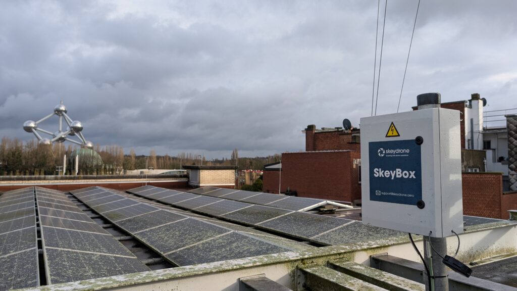
Steenokkerzeel, 15 December 2025 – SkeyDrone is proud to announce a new partnership with Amab, a leading Belgian social enterprise for customised work, to assemble SkeyBoxes, SkeyDrone’s signature hardware component used across its drone detection deployments.
As demand for SkeyDrone’s solutions continues to grow in Belgium and internationally, the company is expanding its production capacity while reinforcing its commitment to local, inclusive and high-quality manufacturing. Amab, known for its strong track record in precision assembly and its mission to create meaningful employment opportunities, offers a reliable and scalable production environment fully aligned with SkeyDrone’s operational standards.
The collaboration ensures that each unit is assembled with precision and care, while contributing to meaningful employment opportunities for people with disabilities. This clearly reflects SkeyDrone’s key values: innovation, partnerships, care and excellence.
Stijn De Vleeschhouwer, Managing Director of SkeyDrone, commented: “We are delighted to partner with Amab. Their expertise, flexibility and commitment to quality make them an excellent fit for supporting the growth of our operations. This collaboration not only enhances our production capabilities but also reflects our ambition to build a more sustainable and socially conscious value chain.”
Joëlle van der Veeken, Business Development Manager Elektro-Montage of Amab, added: “We are proud that SkeyDrone has chosen Amab as an assembly partner. Our teams are motivated to contribute to innovative technologies that enhance safety in the airspace. This partnership highlights how social enterprises can play an important role in high-tech industries.”
The first batch of Amab-assembled SkeyBoxes has already been delivered and deployed, with additional production planned in the coming months as SkeyDrone continues to strengthen its footprint in the drone detection domain.
About SkeyDrone
SkeyDrone is a joint venture between the Belgian Air Navigation Service Provider skeyes and Brussels Airport Company. The company’s mission is to provide end-to-end solutions for all your business needs related to the use of uncrewed aircraft (drones). SkeyDrone offers solutions for lower airspace monitoring, management and protection against drones for authorities and geo-zone managers, UTM/U-space & consultancy services for drone operators and business integration services for companies. Playing a pivotal role in the implementation of U-space in Belgium, SkeyDrone is on track to make history by becoming one of the first U-space service providers in Europe.
About Amab
Amab is a modern and reliable social enterprise for customised work (in the past referred to as a sheltered workshop), which has 800 employees in three easy-to-reach locations around Brussels, namely Asse, Beersel and Zaventem. Amab is aiming for a People, Profit and Planet environment that inspires people to personal growth who are not able to work in a normal work environment.
This month, we’re celebrating an important milestone at SkeyDrone: our Senior Product Manager, Tom Snyers, marks his 5-year anniversary with the company.
Tom joined SkeyDrone after several years in the innovation team at skeyes, Belgium’s air navigation service provider. For him, the move felt like a natural next step: “At skeyes, I was exploring innovative ideas, but at SkeyDrone I had the opportunity to actually build them and bring them to market. It was the chance to help shape a new industry from the ground up.”
That sense of momentum was clear from day one. Tom recalls walking into his first meeting; the kick off with an external development team to build the UTM platform. “From that moment, everything became very real. We weren’t just talking about possibilities anymore, we were creating them.”
Over the past five years, Tom has helped building solutions that push the boundaries of drone integration. One highlight was his presentation at Airspace World 2025 in Lisbon, where he introduced SkeyDrone’s concept of adding dynamic airport threat zones to the Drone Radar solution. It was the first time the idea was shared publicly, and the positive reactions confirmed it met a clear need in the industry. “That was a relief,” Tom admits. “It showed us we were on the right track.”
Tom presenting the concept of dynamic airport threat zones at Airspaice World 2025 in Lisbon
But beyond the projects and milestones, what stands out most for Tom is the team. Working in a start-up has taught him the value of collaboration and trust: “Having colleagues who are open-minded, confident, and aligned on purpose makes all the difference. Open communication—with each other, with customers, with partners—is essential.”
Of course, not all memories are tied to product launches or presentations. Tom often tries to step out of his comfort zone during team events to make his co-workers smile, whether by performing at karaoke nights, or dressing up as Santa for the office Christmas party.
Asked what advice he would give to newcomers at SkeyDrone, Tom doesn’t hesitate: “Don’t deliver half work but always aim for quality. And be open to feedback and different opinions. It’s through collaboration and listening to others that you really grow.”
As we celebrate this 5-year milestone, we want to thank Tom for his dedication, his vision, and his contribution to shaping SkeyDrone into what it is today. Here’s to the next chapter in this exciting journey!
Interested in more employee stories? Read the interview with Chloé here.
Over the past weeks, Europe has faced a wave of unidentified drone sightings near airports and military installations, causing temporary airspace closures and heightened security alerts. These incidents, described by Danish authorities as “hybrid attacks”, underline the growing importance of responsible drone reporting and public awareness.
Since then, our mailbox at SkeyDrone has been filling up with messages from concerned citizens across Belgium who have seen drones and are unsure what to do. It’s a valid concern. While some drone pilots may be clueless, careless or even criminal, drones are increasingly being used for legitimate, valuable purposes. Think about infrastructure inspection, emergency response, aerial photography, medical sample delivery and more. To keep it all safe and secure, both on the ground and in the air, these operations are strictly regulated. It’s essential that every drone pilot follows the rules.
So, what should you do if you encounter a drone?
1. Stay Calm and Assess the Situation
If you see a drone, don’t panic. Definitely not every drone in the air is flying illegally. Many drone operators are licensed and fly according to the drone regulations. On top of that, the vast majority of unauthorised flights are carried out by pilots who are simply unaware of the rules and have no criminal intent.
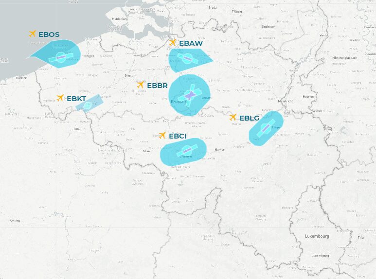
In many parts of the Belgian airspace, restrictions for drone flights apply since so-called geozones are active there, for instance above airports, military bases, nuclear plants, and prisons. You can find an overview of all geozones and their access conditions on map.droneguide.be. In most geozones, drone pilots must obtain a flight authorisation from the geozone manager before taking off. For example, in all military geozones (red on the map) and in the geozones associated to the six major civil airports in Belgium (blue on the map), drone operators must get their flight authorisation via the Drones & Aerial Activities platform from skeyes, powered by SkeyDrone.
Example of geozones where authorisation is required, i.e. military (red) and airport (blue) geozones
So when a drone is observed in a geozone, the geozone manager can quickly verify whether this specific flight was authorised or not.
2. How SkeyDrone Helps
To ensure all drone pilots are flying by the rules, geozone managers can go a step further and make use of a drone detection system. By combining detection data with their own flight authorisation records, they can instantly determine wither a flight is friendly or not.
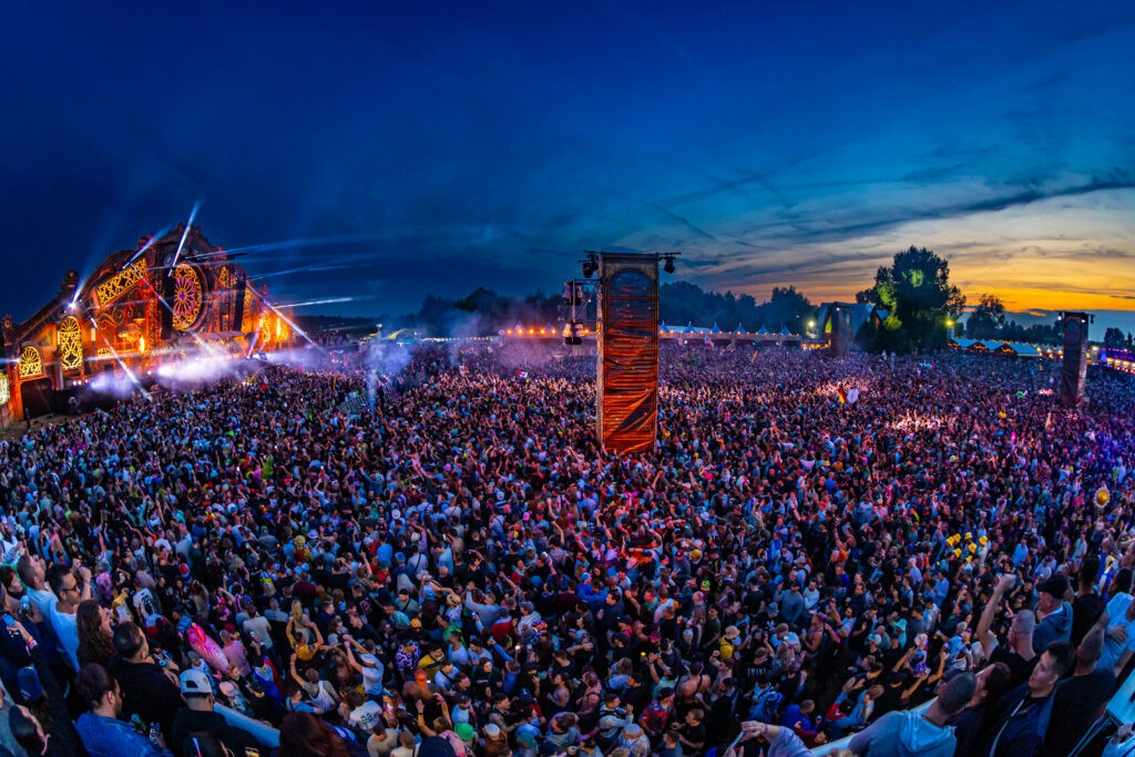
SkeyDrone’s drone detection system is active around the major airports and several other strategic locations in Belgium. Our system automatically picks up drones flying in these geozones and informs the geozone manager about the type of drone, its serial number, whether that flight was authorised and the location of the pilot. When necessary, the police can then be dispatched to the pilot’s location to intervene. For example, during last summer’s Tomorrowland festival in Boom, our system helped authorities to intercept and confiscate 14 illegal drones.
3. How to Report a Drone
If you’re concerned about a drone, call your local police on 101 and provide as much detail as possible:
Time and location of the sighting
Estimated height and direction of the flight
Description of the drone (colour, size, number of rotors, lights)
Photos or videos can help, but only if you can capture them safely.
4. What NOT to do
Never try to approach, jam, or shoot down a drone yourself. These actions are dangerous, illegal, and may cause serious accidents. Only the police or military are authorised to neutralise a drone.
Our Mission at SkeyDrone
At SkeyDrone, we’re committed to creating a safe and secure airspace for all responsible drone pilots. Whether it’s protecting sensitive zones or enabling innovative drone applications, we’re here to help. Want to know more about how we keep Belgian airspace safe? Discover our drone detection solution here.
Sint-Truiden, 26 September 2025 – The Belgian Technical Integration Exercise (TIE) 2025, organised by Agoria, brought together industry leaders, policymakers, and technology providers from 22 to 26 September at DronePort in Sint-Truiden. The week-long event marked a pivotal moment for collaborative innovation in counter-uncrewed aircraft systems (C-UAS) technologies, fostering dialogue on the operational, technical, legal, and ethical aspects of safeguarding airspace.
The initiative culminated on Friday 26 September with a Public Day, where a broader audience was invited to witness live demonstrations, integrated data visualisations, and the official presentation of the C-UAS White Paper.
As part of the programme, SkeyDrone demonstrated the hardware-agnostic capabilities of its drone detection platform, underlining its flexibility and future-proof approach to airspace safety & security. While the company’s nationwide deployments currently rely primarily on Senhive’s RF-based SENID+ sensors, the demonstration highlighted seamless integrations with additional leading providers, including ZSE, Robin Radar, BSS and Sphear.
“This demonstration confirms SkeyDrone’s ability to integrate multiple sensor technologies into one coherent operational picture,” said Kristof Gilleman, Head of Product and Operationsat SkeyDrone. “By proving our platform is truly hardware-agnostic, we can provide our customers with robust, scalable, and flexible C-UAS solutions tailored to their specific needs, without being locked into a single hardware vendor.”
Marcel Verdonk, CCO at Robin Radar commented: “The benefits of combining our market-leading IRIS drone detection radar with an end-to-end solution like SkeyDrone’s are tremendous. The recent drone incursions that shut down airports across Europe are a stark reminder to protect our airspace and keep it secure.”
Agoria’s initiative reinforces Belgium’s leadership in fostering innovation and integration in drone security, setting the stage for continued advancements in the sector.
About SkeyDrone
SkeyDrone is a joint venture between the Belgian Air Navigation Service Provider skeyes and Brussels Airport Company. The company’s mission is to provide end-to-end solutions for all business needs related to the use of uncrewed aircraft (drones). SkeyDrone offers solutions for lower airspace monitoring, management and protection against drones for authorities and geozone managers, UTM/U-space & consultancy services for drone operators and business integration services for companies. Playing a pivotal role in the implementation of U-space in Belgium, SkeyDrone is on track to make history by becoming one of the first certified U-space service providers in Europe.
Steenokkerzeel, 24 September 2025 – SkeyDrone is proud to announce a landmark agreement with Elia, Belgium’s high-voltage transmission system operator, for the deployment of its advanced drone detection solution across multiple sites.
With its strategic position in the heart of Europe, Elia plays a pivotal role in the interconnected electricity system and is recognized as an essential pillar of the European energy market. As emerging global and national threats intensify and the energy sector faces increasing attention from the public and media, Elia remains committed to safeguarding the integrity and resilience of its operations.
Following an extensive evaluation process comparing international alternatives, Elia selected SkeyDrone for its innovative technology, operational reliability, and user-centric software features. This multi-site deployment marks a significant step in Elia’s commitment to enhancing security and operational resilience in an increasingly complex threat landscape.
“The implementation of a cutting-edge drone detection system is a strategic move to safeguard our infrastructure and ensure uninterrupted operations,” said Tom Hauben, Physical Security Manager at Elia. “SkeyDrone’s solution stood out for its intuitive front-end visualization, powerful analytics, and the ability to replay flight paths and identify pilot positions post-flight. These features, combined with a responsive helpdesk, made SkeyDrone the clear choice.”
Didier Decaestecker, Head of Sales at SkeyDrone added: “We are honored to support Elia in securing their infrastructure. This partnership reflects our shared commitment to innovation, safety, and operational excellence. Our solution is designed to empower organizations like Elia with real-time insights and actionable intelligence, ensuring they stay ahead of emerging threats in the airspace.”
This partnership underscores SkeyDrone’s position as a trusted provider of airspace security solutions and highlights the growing importance of drone detection in infrastructure protection.
About Elia
Elia Transmission Belgium operates the electricity transmission network in Belgium. They manage the Belgian high-voltage transmission grid (30 kV to 400 kV), which comprises over 8,903 km of overhead lines and underground cables. They preserve a service reliability level of 99.99 % and ensure that production and consumption are balanced around the clock. In so doing, they provide society with a robust power grid, which is important for socioeconomic prosperity.
About SkeyDrone
SkeyDrone is a joint venture between the Belgian Air Navigation Service Provider skeyes and Brussels Airport Company. The company’s mission is to provide end-to-end solutions for business needs related to the use of uncrewed aircraft (drones). SkeyDrone offers solutions for lower airspace monitoring, management of and protection against drones for authorities and geo-zone managers, UTM/U-space & consultancy services for drone operators and business integration services for companies. Playing a pivotal role in the implementation of U-space in Belgium, SkeyDrone is on track to make history by becoming one of the first U-space service providers in Europe.
At SkeyDrone, we believe that great user experience isn’t just about big features—it’s about the little things that make your day smoother. That’s why we continuously refine our solutions to make them more intuitive, reliable and aligned with the needs of our users.
This week, our engineering team has rolled out a set of updates focused on refining the user journey and squashing bugs that were getting in the way. Several of these improvements were inspired directly by your feedback, underscoring how closely we listen to and act on your input.
For professionals who rely on our drone detection technology, every detail counts. Whether it’s monitoring airspace activity, analysing data, or coordinating operations, efficiency and clarity are essential. Our goal is to make sure the platform not only delivers accurate insights, but does so in a way that feels seamless.
What’s New?
In Drone Analytics
Custom labels created in Drone Radar are now available in Drone Analytics too (see header image) so you only label flights once, keep the same context across both tools, and more easily identify your drones.
The map no longer zooms out when deselecting a flight so you keep your focus and don’t lose your view of the airspace.
Mobile users can now dismiss the login popup on the public view by tapping the “Close” button so you can easily close it and switch to full-screen flight view.
In Drone Radar
You can now select the map style when creating or editing a control zone so you can choose the background that best fits your needs when defining a zone.
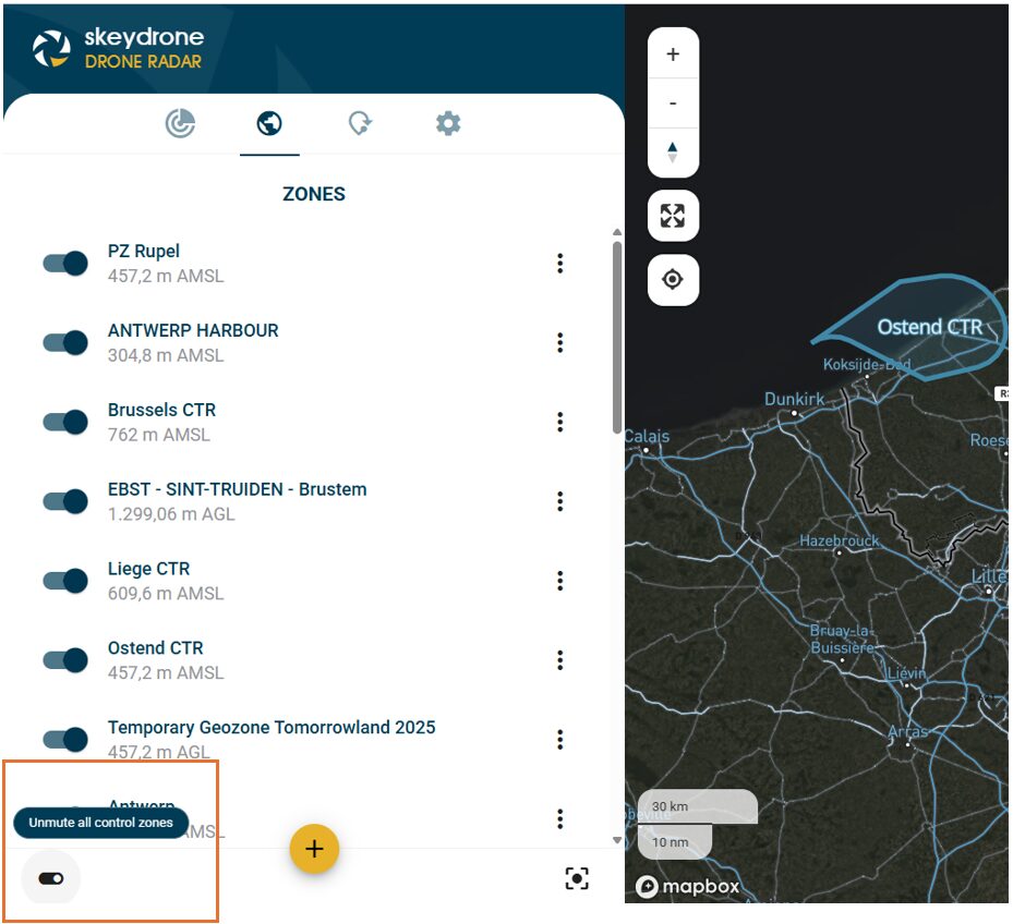
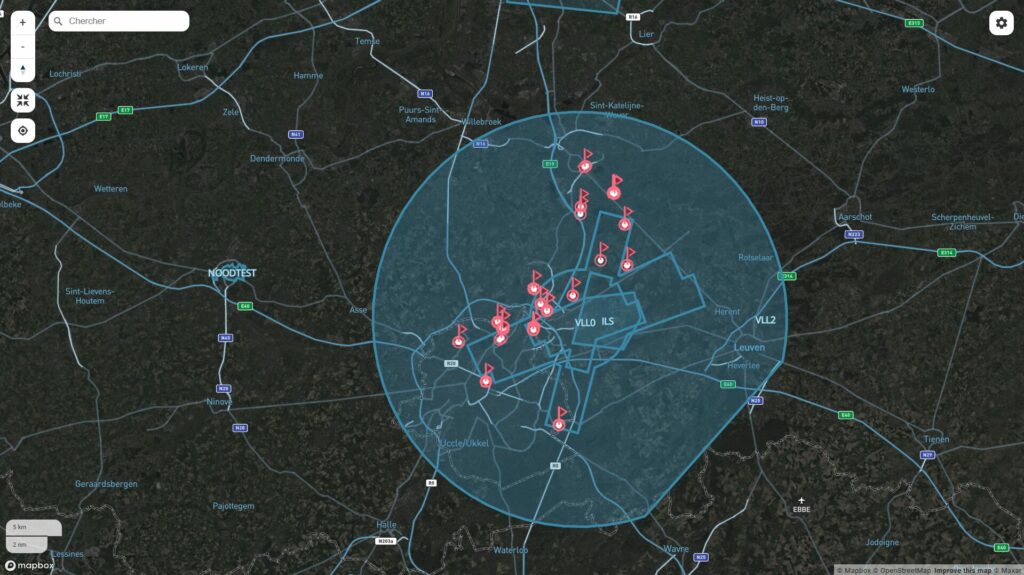
All control zones can be toggled on or off with a single checkbox so you can declutter the map instantly and focus on what matters (see image below).
When you restrict traffic to manned, the unmanned traffic settings are automatically disabled and your configuration stays consistent.
The GCS abbreviation on the map is now displayed in full as Controller so terminology is clear for everyone, especially new users.
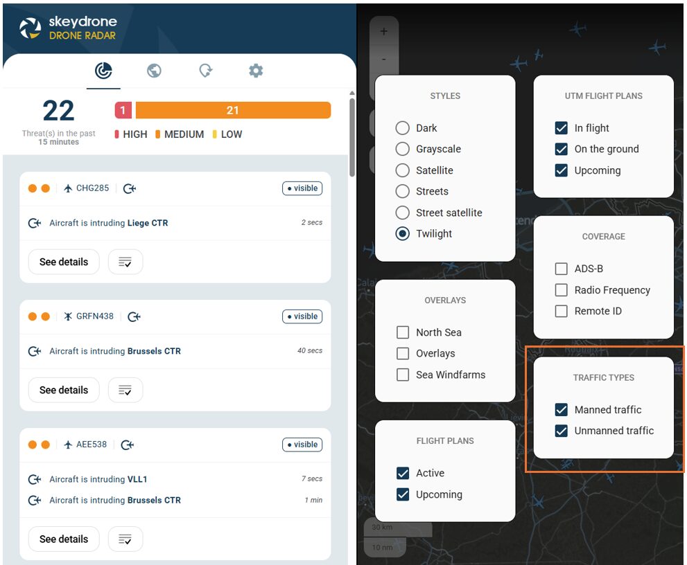
You can now choose which type of traffic to display on the map—manned, unmanned, or both so you can focus on the airspace view of interest to you, without affecting the threat panel (see image below).
A checkbox can toggle all control zones on or off.
Choose which type of traffic to display on the map.
We’d Love Your Feedback
Your feedback plays a crucial role in shaping our products. If you have suggestions for further improvements, please submit them directly in the Hub, using the dedicated button from the Help Center.
Steenokkerzeel, 4 September 2025 – SkeyDrone is pleased to announce the appointment of Stijn De Vleeschhouwer as its new Managing Director, effective today. He is succeeding Hendrik-Jan Van Der Gucht, who leaves the company at the end of the month for a new challenge.
Stijn De Vleeschhouwer brings extensive experience in building teams, business growth & strategy, and will guide SkeyDrone through its next phase of growth and innovation. His appointment reflects the company’s commitment to advancing safe and efficient drone operations across Europe.
Founded in 2020, SkeyDrone, a subsidiary of skeyes and Brussels Airport Company, has rapidly developed into a trusted partner for the drone ecosystem. With a strong focus on U-space services and drone detection capabilities, the company is shaping the safe integration of drones into European airspace.
“We are enthusiastic to welcome Stijn to SkeyDrone,” said Arnaud Feist, Chairman of the Board. “His strategic mindset and business expertise will be critical to drive the growth of the company and continue delivering innovative solutions to our customers.”
The Board would also like to sincerely thank Hendrik-Jan Van Der Gucht for his leadership and dedication as Managing Director over the past five and a half years. Under his guidance, SkeyDrone has become a key player in the emerging European drone ecosystem. He will remain with the company until 30 September to ensure a smooth transition.
“I am honoured to join SkeyDrone,” said Stijn De Vleeschhouwer, Managing Director at SkeyDrone. “The drone industry is entering a pivotal phase, and I look forward to working with the team to build on SkeyDrone’s strong foundations and unlock the full potential of drone technology for society and industry.”
About SkeyDrone
SkeyDrone is a joint venture between the Belgian Air Navigation Service Provider skeyes and Brussels Airport Company. The company’s mission is to provide end-to-end solutions for all business needs related to the use of uncrewed aircraft (drones). SkeyDrone offers solutions for lower airspace monitoring, management and protection against drones for authorities and geozone managers, UTM/U-space & consultancy services for drone operators and business integration services for companies. Playing a pivotal role in the implementation of U-space in Belgium, SkeyDrone is on track to make history by becoming one of the first certified U-space service providers in Europe.
Steenokkerzeel/Sint-Truiden, 26 August 2025 – SkeyDrone and DronePort Sint-Truiden are proud to announce a strategic partnership to establish Belgium’s first permanent Drone Detection & Counter-UAS (C-UAS) Testing and Expertise Centre. This national hub will enable manufacturers of detection and C-UAS systems to test, validate and demonstrate their solutions, and integrate them into a comprehensive, multi-layered C-UAS system designed for both defence and civil authority use.
With drones becoming increasingly present in society, both for legitimate and malicious purposes, the demand for robust, interoperable C-UAS solutions has never been greater. In Belgium and across Europe, government agencies, critical infrastructure operators, and defence forces are seeking integrated detection and mitigation capabilities that are tested, validated, and proven in operational settings. Meeting this demand calls for state-of-the-art infrastructure combined with advanced system integration expertise, precisely what this new centre will deliver.
Complementary Strengths, Shared Vision
DronePortSint-Truiden will provide the physical infrastructure and secure, real-world operational environment necessary for continuous testing, demonstrations, and stakeholder collaboration, opening its facilities to a wide range of parties developing both C-UAS systems and advanced drone technologies, and creating an environment where opposing technologies can challenge each other to enhance and future-proof airspace security.
SkeyDrone, as operator of Belgium’s national backbone drone detection network and U-space service provider, will enable the technical integration of the various subsystems, manage the interfaces with civil aviation stakeholders, safeguard compliance with regulatory frameworks, and connect participating solutions to its existing detection network.
National Operational Backbone
Looking ahead, SkeyDrone envisages to operate its national base detection network and services from DronePort Sint-Truiden. This network already serves critical infrastructure across Belgium, including airports, strategic energy production and distribution sites, prisons, and offshore wind farms, as well as several local police zones. From DronePort Sint-Truiden, SkeyDrone plans to deliver real-time monitoring and alerting services nationwide.
Strategic Impact
This partnership will:
Establish Belgium’s national testbedfor C-UAS innovation, accelerating time-to-market for Belgian and European technology providers.
Strengthen Belgium’s technological sovereignty in C-UAS capabilities.
Offer defence and civil authorities a trusted platform for evaluating and selecting integrated solutions.
Position Belgium as a European reference centre for drone detection and non-kinetic counter-drone technologies.
Ward Decaluwé, CEO of DronePort Sint-Truiden, commented: “With this C-UAS Centre, DronePort Sint-Truiden further establishes itself as the beating heart of Belgium’s drone ecosystem. By combining our unique infrastructure with SkeyDrone’s expertise, we are creating an innovation hub where authorities, technology providers, and end users can collaborate to address one of today’s most pressing airspace security challenges.”
Hendrik-Jan Van Der Gucht, Managing Director of SkeyDrone, added: “The establishment of this centre marks a pivotal step in building a safer and more resilient airspace. By leveraging DronePort’s operational environment and integrating it with our national detection backbone, we’re not only enhancing our service capabilities but also fostering a collaborative environment where industry, government, and defence can co-create the future of airspace security.”
About SkeyDrone
SkeyDrone is a joint venture between the Belgian Air Navigation Service Provider skeyes and Brussels Airport Company. The company’s mission is to provide end-to-end solutions for all your business needs related to the use of uncrewed aircraft (drones). SkeyDrone offers solutions for lower airspace monitoring, management and protection against drones for authorities and geozone managers, UTM/U-space & consultancy services for drone operators and business integration services for companies. Playing a pivotal role in the implementation of U-space in Belgium, SkeyDrone is on track to make history by becoming one of the first certified U-space service providers in Europe.
About DronePort Sint-Truiden
DronePort Sint-Truiden is a unique 30ha industry park for innovative aviation companies, offering an ecosystem of innovative businesses and testing grounds within the aerospace and drone sector. DronePort Sint-Truiden offers state-of-the-art test facilities with segregated airspace, allowing you to test and demonstrate new applications to customers and train uncrewed aircraft system (UAS) pilots. All test grounds are managed by Limburg Regional Airport in close collaboration with the Belgian Civil Aviation Authority (BCAA), ensuring safe operations. Additionally, there are specialized testing grounds tailored to specific drone applications, such as for agriculture applications and BVLOS flights.
Steenokkerzeel/Hasselt, 5 August 2025 – Since early July, the Limburg Regio Hoofdstad police zone has been using SkeyDrone’s advanced drone detection system to protect the city of Hasselt and its more than 80,000 residents. With this system, Hasselt becomes the first Belgian city to be permanently safeguarded against unauthorised or illegal drone activity. The technology enhances public safety and enables the police to respond more quickly and effectively to violations and criminal drone use.
Each year, the police zone receives around one hundred reports from citizens concerning drones, often due to privacy concerns when drones fly over private homes. In addition, there have already been incidents involving drones dropping objects or being used in other criminal activities. Enforcement is also particularly challenging during events where drone flights are prohibited and in designated no-fly zones in and around Hasselt.
Police Chief Philip Pirard explains: “Without a detection system, it is nearly impossible to catch a drone pilot in the act. Thanks to SkeyDrone’s technology, we can now pinpoint the exact location of a pilot as soon as a report comes in and immediately dispatch a patrol. After a successful trial in 2024, we decided to invest in this system.”
An additional benefit is that the police zone’s own drone pilots can now operate more safely. During their missions, they can see the positions of other drones in the airspace, significantly reducing the risk of accidents.
Kristof Gilleman, Head of Product & Operations at SkeyDrone, adds: “We are proud to equip Hasselt as the first Belgian city with a permanent drone detection system. This is a major step toward safe and responsible drone use in urban environments. We hope Hasselt’s example will inspire other cities and municipalities to follow suit.”
The detection equipment is strategically installed at a central location in Hasselt, covering an area with a radius of over five kilometres. Since its deployment, 244 drone flights have been detected, 168 of which originated from emergency services such as the fire brigade and police. Twelve flights exceeded the maximum permitted height of 120 metres. The most striking violation involved a drone flying at a height of 406 metres, crossing the approach path of Kiewit Airport, which was active at the time.
About SkeyDrone
SkeyDrone is a joint venture between the Belgian Air Navigation Service Provider skeyes and Brussels Airport Company. The company’s mission is to provide end-to-end solutions for business needs related to the use of uncrewed aircraft (drones). SkeyDrone offers solutions for lower airspace monitoring, management of and protection against drones for authorities and geo-zone managers, UTM/U-space & consultancy services for drone operators and business integration services for companies. Playing a pivotal role in the implementation of U-space in Belgium, SkeyDrone is on track to make history by becoming one of the first U-space service providers in Europe.
About Police Zone Limburg Regio Hoofdstad
The Limburg Regio Hoofdstad police zone is responsible for the safety and quality of life in the municipalities of Alken, Diepenbeek, Halen, Hasselt, Herk-de-Stad, Lummen, and Zonhoven. In 2024, the zone carried out 31,919 interventions, of which 20,680 took place in Hasselt. The force consists of over 400 experienced and dedicated police officers.
Steenokkerzeel/Francorchamps, 18 July 2025 – SkeyDrone is proud to announce that its cutting-edge drone detection system will safeguard the Formula 1 Belgian Grand Prix at Spa-Francorchamps, taking place from 25 to 27 July 2025.
This year marks a historic milestone for Formula 1 as it celebrates its 75th anniversary. Since 1950, this legendary championship has seen the greatest drivers battle on iconic tracks. Among them, Spa-Francorchamps holds a special place with its spectacular layout, legendary corners like Eau Rouge, and an atmosphere like no other.
As tens of thousands of spectators, teams, and media representatives gather at the iconic circuit, SkeyDrone will work closely with event organisers and security teams to ensure a safe and secure race weekend. Its state-of-the-art drone detection system delivers real-time insights into drone activity, including the drone’s model, height, speed, and location—as well as the drone pilot’s position. This enables rapid threat assessment and response, helping to prevent disruptions caused by unauthorised or malicious drone flights.
Given that a limited number of drones will be authorised to operate during the event, SkeyDrone’s whitelisting feature is particularly valuable. This functionality allows the security team to distinguish between known operations and potential threats, enabling them to focus their attention where it matters most.
“Protecting high-profile events like the Formula 1 Belgian Grand Prix requires precision, reliability, and seamless collaboration,” said Didier Decaestecker, Head of Sales at SkeyDrone. “We’re honoured to support this world-class event by securing the lower airspace and reinforcing the safety and security of both attendees and participants.”
“Safety is our number one priority, both on and off the track,” added François Detroux, Logistics & Security Manager at Spa Grand Prix. “With the increasing presence of drones at major events, it is essential to take proactive measures to protect our fans, staff, and teams. The solution deployed by SkeyDrone offers us a clear view of the airspace and helps ensure that the event runs smoothly and securely.”
This deployment at Spa-Francorchamps builds on SkeyDrone’s growing track record of securing large public gatherings, including music festivals, sporting events, and critical infrastructure sites. The integration of drone detection into broader security operations reflects a growing trend towards smarter, air-aware event management in Belgium and across Europe.
About SkeyDrone
SkeyDrone is a joint venture between the Belgian Air Navigation Service Provider skeyes and Brussels Airport Company. The company’s mission is to provide end-to-end solutions for business needs related to the use of uncrewed aircraft (drones). SkeyDrone offers solutions for lower airspace monitoring, management of and protection against drones for authorities and geo-zone managers, UTM/U-space & consultancy services for drone operators and business integration services for companies. Playing a pivotal role in the implementation of U-space in Belgium, SkeyDrone is on track to make history by becoming one of the first U-space service providers in Europe.
About Spa Grand Prix
Spa Grand Prix is the official promoter of the Belgian Grand Prix, held at the iconic Circuit de Spa-Francorchamps. They are responsible for organizing and promoting the Formula 1 Belgian Grand Prix, coordinating with Formula 1 Management and local authorities as well as managing ticketing, logistics, and fan experience.
We’re excited to introduce a transformative upgrade to Drone Radar and Monitor—shifting from an alert-based model to a threat-based system, offering a smarter, more strategic way to monitor drone activity.
Goodbye alerts
Previously, each incident—such as entering a restricted zone or exceeding altitude—generated a separate alert. While each alert was grouped by Control Zone and Flight Plan, users still had to manually connect the dots to understand the real risk.
Hello threat-based assessment
With the new threat-based approach, Drone Radar now assesses drone behaviour across an entire flight. Multiple alerts are grouped together under a single threat, and a threat level is assigned.
What’s a threat? A threat is a full-picture evaluation of a drone flight—not just isolated events.
Benefits include:
Critical decision-making: Focus on what truly matters.
Reducing cognitive overload: One flight = one threat.
Security & law enforcement: Respond faster to high-risk situations.
The airspace you monitor, the rules you define
As a user, you can customise which incident types matter to you and assign threat levels – from low to high – that reflect your own operational reality. For example, an unauthorised control zone intrusion may be marked as High, while a minor flight plan deviation could be Medium or Low.
Key enhancements and new capabilities
Threat levels per incident: Choose how critical each incident type is to you — for example, an unauthorised control zone intrusion may be marked as High, while a minor flight plan deviation could be Medium or Low.
Visual prioritisation in the UI & better UX: Easily spot what deserves attention with threat levels and color-coded visual cues.
Past incidents now stay visible for 15 minutes: Any incident — even if resolved — stays displayed for 15 minutes, giving your team time to review, assess, and act on short-lived or recently ended threats.
Seamless integration with Drone Analytics: Dive deeper into flight details instantly.
The bottom line
This isn’t just a feature upgrade—it’s a strategic leap forward. With threat-based detection, Drone Radar moves from passive monitoring to active risk management, giving users the clarity and control they need to secure the airspace they monitor.
Ready to experience the new threat-based system? Log in to the SkeyDrone Hub to see these new features in action.
From Criminology to Aviation: A Passion Turned Profession
Meet Jan Keymis, SkeyDrone’s dedicated project manager who joined the team two years ago. With a decade of professional experience under his belt, Jan decided it was time to pursue his passion for aviation—sparked during his many travels. A friend working at Brussels Airport pointed him towards a vacancy at SkeyDrone—and the rest is history.
Jan’s interest in drones started back in 2016 while travelling. Eager to capture high-quality footage of his adventures, he became an early adopter of the DJI Mavic—one of the first easily transportable drones on the market. That early curiosity laid the foundation for a deeper interest that would eventually guide his career.
Upon joining SkeyDrone, Jan was immediately thrown into the deep end: leading a pioneering drone use case project at Brussels Airport. The project involved using AI models to analyse drone footage—new territory at the time for everyone involved. Jan successfully managed the entire project from start to finish and takes great pride in the innovative results the team achieved.
Jan flying his drone over a closed runway at Brussels Airport
Making a Societal Impact
Jan is particularly proud that his work contributes to something bigger than himself. “It’s important to me that my work has a societal impact,” he explains. “I’m proud to help shape the future of drone technology and its safe integration into everyday life.”
Jan holds a master’s degree in criminology, which surprisingly comes in handy more often than one might expect. For example, while preparing a drone surveillance mission, his knowledge of camera legislation proved instrumental in ensuring legal compliance.
Climbing High
Outside of work, Jan is an avid traveller and adrenaline enthusiast. He enjoys extreme sports such as climbing, diving and canyoning. His climbing skills are regularly put to good use during the installation of SkeyDrone’s drone detection antennas. Over the past two years, he has scaled some of Belgian’s highest buildings as part of his role.
Thanks to his hands-on experience with construction work at his own home, co-engineering and building the SkeyBoxes—which ensure reliable connectivity for the detection antennas—was a natural extension of his skills. Whether it’s climbing buildings or fine-tuning technical setups, Jan brings both precision and passion to every task.
With summer on the horizon, Jan is excited to once again lead antenna installations at high-profile events like Tomorrowland, Spa-Francorchamps and Lokerse Feesten.
Jan installing a drone detection antenna
Elevating Operations
Another aspect of his job he truly enjoys is operating drone missions on behalf of SkeyDrone. A recent highlight includes supporting Belgium’s first BVLOS drone flight in active airspace—a significant milestone for the industry.
When asked what he enjoys most about his job, Jan says: “It’s the variety. No two days are the same.”
Looking ahead, he hopes to see the regulatory framework for drones evolve quickly so the industry can realise its full potential. And if the past two years are anything to go by, Jan will continue to be at the forefront of making that future a reality!
Interested in more employee stories? Read the interview with Chloé here.
As drones increasingly operate near critical infrastructure, international airports and Air Navigation Service Providers (ANSPs) must adopt effective strategies to ensure airspace safety and security. In this recent webinar, we presented how a fully EASA-compliant drone incident management system is deployed at Brussels Airport.
David Van Acker, Senior Tower Manager at skeyes, outlined the concept of operations behind the initiative.
Didier Decaestecker, Head of Sales at SkeyDrone, demonstrated how EASA guidance has been translated into a robust, operational drone detection system.
Yves Brouwers, Senior Consultant in Safety & Emergency Management at Airport Intelligence, shared best practices for responding to drone threats while ensuring safe and continuous airport operations.
Please enable JavaScript in your browser to complete this form.
Please enable JavaScript in your browser to complete this form.
Q&A overview
While the webinar recording doesn’t include the Q&A segment, fear not! We’ve compiled the most pressing questions and expert answers below, organised into three key themes:
1. Detection System: How It Works
Q: You are using several sensors to detect drones. How are the different sensors fused together in the final detection of drones?
A: Several drone detection sensors are indeed connected to our system. Multiple sensors are required to cover larger areas or to detect drones at different heights in demanding environments (e.g. urban areas or hilly terrain). The data from the different sensors are fused together into a single drone object in the data fusion layer by taking into account time, position and drone characteristics such as serial number. This prevents displaying the same drone multiple times on the screen.
Q: How do you distinguish authorised from unauthorised drones?
A: This is done via the the Uncrewed Traffic Management (UTM) integration. In the UTM system, drone operators submit their UAS Serial Number, flight plan and timing. When a drone is detected in the area and at the time of an authorised flight, using the correct device, the detection system automatically recognises it as “authorised”.
Q: How does your detection system differentiate between birds and drones in the air?
A: We detect cooperative drones via their direct remote id. For non-cooperative drones, we use Radio Frequency (RF) analysis, extracting all the information from the RF communication between drones and their remote control. This way we can detect all commercially available drones of which we have a fingerprint in our decryption database which is continuously updated. Unknown types of drones are signaled, and can be located when detected by multiple antennas (principle of multilateration). Birds are only a concern to active radar systems, as they don’t get detected via RF.
Q: Did you have to deploy specific hardware to detect the RF signals between the drones and the remote control? And how do you differentiate at proximity of airports inside the EASA zones whereas if the RF signal is coming from a remote control or not?
A: We installed several SENid+ sensors in the airport area. The RF signals are going in two directions, emitted by the drone towards the remote control, or emitted from the remote control towards the drone. The system intercepts both signals and by reading the data inside the signal, we can determine the location and height of the drone, but also the location of the remote control. This allows not only to make the user aware of the location of the drone in the air, but also the valuable location of where the pilot that is controlling the drone is located.
2. Threat Zone Configuration
Q: How do you define those red, orange and yellow threat zones?
A: We used the guidelines from EASA that are available for ANSPs, and translated those to the context of Brussels Airport. By doing so, we’ve reduced the number of drone detections that need to be looked into with 97%. We want to make sure we only divert airplanes or close runways or the airport when we absolutely have no other choice.
Q: To what distance at the end of the runways do you monitor? Do you use the same criteria for cooperative/non-cooperative drones in those areas, or do you class them all as ‘red’?
A: The red threat zone extends up to 1852 meters. While drones are not allowed in the proximity of an active runway, occasionally the police receives authorisation from the tower to fly at a low height of about 20 meters. These flights would show as red in the system, but since the tower is aware, this obviously wouldn’t be a threat. Only unknown drones trigger a reaction.
3. Responding To Threats
Q: When an alarm from detection system arises in the red zone: 1. How do you discard that it is or is not a false alarm? 2. How much time do you spend to do this analysis and discard the alarm or not? 3. What it is the operational decision during that time you use for analysing the truthiness of such alarm? Do you stop the operations during that period?
A: 1. All detections are real. An alarm is generated if there’s no authorisation in the UTM system or if the operational volume is not respected. However, if there would be exceptionally contact with the drone pilot and the actual mission was known and approved, the alert would be disregarded. 2. The system is built in a way so the alert is pretty straight forward and allows for quick response times. Instantly after the alert, a phone call would be made by the user of the drone detection system towards ATC to check the situation. 3. A phone call to the tower supervisor would almost instantly lead to a quick analysis and response by Air Traffic Control (ATC). Possible responses include suspending or delaying flight operations, closing affected runways, redirecting or rerouting traffic.
Q: How is follow-up and enforcement organised? Detecting is the first step but how is the drone owner apprehended? What role does surveillance and police have?
A: The first action is to alert ATC when a drone is detected at the airport. We have special procedures in place for intrusion, which will be deployed in a first phase. These procedures include a cooperation between ATC, Security and Aerodrome Operations, and Airport Police. This procedure is activated to make sure aircraft and staff are safe and secure. In a second phase, we will warn the central dispatching of the police so they can send a team to the location of the pilot, since the drone detection system displays the location of the pilot. While some drone flights might be too short for that, SkeyDrone’s Drone Analytics module offers the possibility to analyse all details of past drone flights which can be shared with the police or the Civil Aviation Authority after the facts for prosecution.
We’d like to thank everyone who attended the webinar and contributed to the lively Q&A. If you missed the session or want to revisit it, you can access the recording here.
At SkeyDrone, we are committed to helping our users gain better control, clarity, and confidence in the airspace they manage. Our latest release brings a powerful set of enhancements to Drone Radar and Drone Analytics, designed to streamline monitoring and give users more flexibility in how they interact with the platform.
Here’s a closer look at the new features now available:
1. Advanced monitoring preferences for control zones and flight plans
Customisation is key when managing complex operations, and our new individual monitoring preferences give Drone Radar users exactly that. You can now tailor your monitoring and alert settings per zone or flight plan—without affecting your organisation’s default configuration. Whether you want to receive alerts for intrusions, conformance issues, or other specific events, you’re in full control. This means you’ll never miss what matters most to you, while your team members can stay focused on their own priorities. You can configure default preferences that will be automatically applied to any newly created zone or flight plan. This eliminates the need for repetitive manual configuration, saving time and ensuring consistency across all zones. Control zones will still be created and managed at the organisational level to maintain consistency.
2. Visualise control zones in Drone Analytics
You asked, we delivered. Drone Analytics now offers a clear visual display of control zones and Areas of Responsibility (AoRs) directly on the map. With just a click in the map settings, you can show or hide these zones based on your operational needs. This new feature provides the visual clarity needed to stay in control.
Figure 1: Visualise your control zones and areas of responsabilities on the map in Drone Analytics
3. Map zoom level preserved when filtering
Drone Analytics users can now adjust filters without losing their current zoom level. This small but powerful improvement ensures the map stays focused on the area that matters most—making it easier to maintain context as you refine your view.
4. New Twilight map view as default
Introducing the Twilight Street-Satellite Map (see figure 1), now the default map style in both Drone Radar and Drone Analytics. This hybrid view combines detailed street maps with high-resolution satellite imagery to help you quickly identify key landmarks. The darker tones increase contrast and improve drone visibility—especially in busy or complex airspaces.
5. Custom labels for whitelisted drones
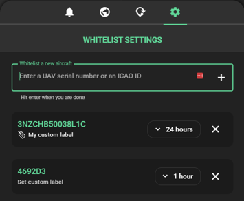
Our earlier update to the whitelisting feature brought new efficiencies, and we’re now expanding on that with custom labels. Easily tag whitelisted drones with names, use cases, or operator identifiers. This makes sorting and identifying friendly traffic simpler and faster during real-time operations.
Figure 2: Add a custom label to your whitelisted drones
6. New preference settings for a more personalised experience
You can now tailor your platform experience with individual settings for measurement units (metres or feet), time display (UTC or CEST), and interface theme (dark or light mode). These preferences are saved at the user level and automatically applied in future sessions—ensuring a consistent experience every time you log in.
These enhancements mark another step forward in our mission to empower users with the tools they need to ensure safe, efficient, and informed drone operations. Whether you’re securing a control zone, assessing drone traffic patterns, or coordinating complex airspace usage, these features are designed to support your operational goals.
Stay tuned—there’s more innovation on the horizon!
In the rapidly evolving world of drone operations, ensuring safety for drones flying Beyond Visual Line of Sight (BVLOS) is paramount. Traditionally, pilots rely on the ‘see and avoid’ principle to navigate safely in the air. However, with BVLOS operations, this principle is replaced by ‘detect and deconflict,’ allowing remote pilots to make informed decisions in real time.
A robust Traffic Information Service (TIS) is a crucial enabler for BVLOS drone operations. Without direct visual contact, pilots must rely on real-time traffic data to safely navigate the airspace and avoid conflicts. SkeyDrone’s TIS goes beyond standard industry solutions, ensuring complete airspace awareness.
Unmatched Coverage: Cooperative and Non-Cooperative Drone Traffic
Unlike conventional solutions that only display cooperative drone traffic, SkeyDrone’s TIS provides a complete picture by incorporating both cooperative and non-cooperative air traffic. Cooperative drones are visualized using either their direct remote ID or their telemetry data. Our nationwide drone detection network captures and displays non-cooperative drones, significantly reducing the risk of mid-air conflicts. This comprehensive approach enhances safety and enables seamless integration of drones into shared airspace.
Beyond Standard Aviation Data: A Holistic Approach
For crewed aviation, our TIS doesn’t just rely on the usual data sources such as Mode-S, ADS-B, and FLARM. We take it a step further by integrating with community-based platforms like SafeSky and ADS-B Exchange. This means that drone pilots gain access to the most extensive real-time traffic data available without the need for additional integrations. By combining multiple data sources, we ensure drone operators have a full, accurate, and continuously updated traffic picture.
Leading the Future of Drone Traffic Management
As drone operations continue to grow, the need for an advanced and reliable Traffic Information Service has never been greater. SkeyDrone’s TIS is setting new industry standards, ensuring that drone operators can conduct BVLOS flights with confidence, efficiency, and, most importantly, safety. By combining real-time data from multiple sources, including non-cooperative traffic detection, SkeyDrone is empowering the future of autonomous and integrated drone operations.
Want to learn more about our TIS? Download the brochure here.
Vilvoorde, 20 March 2025 – For the first time, a drone flight took place in the controlled airspace around Brussels Airport, with active deconfliction between ATM (Air Traffic Management for traditional crewed aviation) and UTM (for uncrewed aviation). skeyes, in its role as Common Information Service Provider (CISP), and SkeyDrone, as a drone operator and U-space Service Provider (USSP), exchanged data intensively, allowing the airspace to remain active for traditional crewed aviation while simultaneously integrating a drone flight safely.
The drone took off from the twelfth floor of the Living Tomorrow Innovation Campus in Vilvoorde. The flight was the result of a collaboration between skeyes, SkeyDrone, Living Tomorrow and DroneLand. This groundbreaking operation marked a significant step in the safe integration of crewed and uncrewed aviation within the Controlled Traffic Region (CTR) of an international airport.
A New Milestone for U-space and Safe Drone Integration
The drone was remotely controlled and crossed the Brussels Ring Road four times. The control signal for the uncrewed aircraft came from the control room of drone operator SkeyDrone, a subsidiary of skeyes and Brussels Airport, located in Steenokkerzeel, 13 kilometers in a straight line from Living Tomorrow. The flight was conducted in close coordination with skeyes, the Air Navigation Service Provider responsible for all flight movements over Belgian territory up to an altitude of 7,500 meters, whether crewed or uncrewed.
The Future of Drone Integration in Belgium
This historic flight highlights Belgium’s efforts to take a leading role in the European aviation sector. Through collaboration between public and private partners, the path is being paved for the safe and efficient integration of drones into our airspace, with applications in logistics, urban mobility, and emergency response.
Johan Decuyper, CEO of skeyes comments: “This flight proves that we are ready to take the next step with drones for beyond visual line of sight operations near complex airspaces around airports. The experiences gained here contribute to a workable ecosystem where economically relevant applications for unmanned aviation are possible, without compromising the safety and efficiency of traditional aviation.”
Living Tomorrow as an Innovative Launch Platform
The choice of the Living Tomorrow Innovation Campus as the take-off location underscores Belgium’s forward-thinking vision for aviation innovation. This iconic building serves as a test environment for new technologies, where drones play a key role in urban mobility and logistics applications.
Yin Oei, CEO of Living Tomorrow adds: “Our campus is the ideal place to demonstrate the future of aviation. We aim to make innovative technologies accessible to businesses and governments, with a focus on sustainability and efficiency.”
The Role of SkeyDrone and DroneLand
As a subsidiary of skeyes, SkeyDrone plays a crucial role in the implementation of U-space in Belgium. U-space is an innovative concept enabling the safe and efficient integration of drones into airspace. Thanks to U-space, drones will be able to operate in busy and complex airspaces, opening new possibilities for commercial and societal applications such as parcel delivery, inspections, and emergency response.
DroneLand, a leading provider of drone solutions in the Benelux, contributes expertise in drone hardware and software. Their extensive knowledge and services, including training and maintenance, support the continued professionalization of drone operations.
Click here to replay the flight in our Drone Analytics solution.
Steenokkerzeel, 11 March 2025 – SkeyDrone is enhancing its Traffic Information Service (TIS) by integrating real-time traffic data from SafeSky while providing SafeSky with uncrewed aircraft data in return. Used by drone pilots operating beyond visual line of sight (BVLOS), SkeyDrone’s TIS offers a comprehensive situational awareness solution by displaying both crewed and uncrewed traffic.
SafeSky, a leading provider of anti-collision technology, offers an app used by over 85,000 pilots across Europe. This includes pilots of helicopters, gliders, paramotors, paragliders, trikes, and other aircraft, who share real-time in-flight traffic data either through the SafeSky mobile app or via one of the 30 integrated hardware and software solutions. By leveraging the GPS chip in their smartphones, SafeSky pilots transmit their position to others within the SafeSky network.
Many SafeSky pilots fly without a (ADS-B or other) transponder, making their aircraft invisible to traditional surveillance systems. By integrating SafeSky data, SkeyDrone’s TIS gains access to additional flight information, further enriching its traffic picture for lower flying aircraft. This ensures that drone operators are fully equipped to fly BVLOS.
In return, SafeSky is receiving cooperative and non-cooperative uncrewed traffic data from SkeyDrone for flights above 500 feet. This integration enables SafeSky pilots to receive drone activity alerts, enhancing safety for all airspace participants.
This collaboration marks an important step towards improving airspace awareness and safety as the skies become increasingly shared between crewed and uncrewed aircraft.
Tristan Fily, CEO of SafeSky, commented, “This collaboration with SkeyDrone is an important milestone in our mission to make the skies safer for all. By sharing our traffic data, we are providing pilots with a more comprehensive view of the airspacereducing the risk of conflicts between crewed and uncrewed aircraft.”
Hendrik-Jan Van Der Gucht, Managing Director of SkeyDrone, added, “We are excited to partner with SafeSky. This data exchange not only improves our Traffic Information Service but also supports the broader goal of safe and efficient airspace integration for both crewed and uncrewed aircraft.”
About SafeSky
SafeSky, a pioneering Belgian start-up founded by six passionate pilots, is a leading provider of real-time air traffic awareness solutions, dedicated to enhancing flight safety for all airspace users. Through its innovative anti-collision app, SafeSky enables pilots of various aircraft—including helicopters, gliders, paramotors, ultralights and general aviation—to share their position and receive real-time traffic alerts. By leveraging collaborative data-sharing, SafeSky contributes to a safer and more integrated airspace.
About SkeyDrone
SkeyDrone is a joint venture between the Belgian Air Navigation Service Provider skeyes and Brussels Airport Company. The company’s mission is to provide end-to-end solutions for business needs related to the use of uncrewed aircraft (drones). SkeyDrone offers solutions for lower airspace monitoring, management of and protection against drones for authorities and geo-zone managers, UTM/U-space & consultancy services for drone operators and business integration services for companies. Playing a pivotal role in the implementation of U-space in Belgium, SkeyDrone is on track to make history by becoming one of the first U-space service providers in Europe.
On the occasion of International Women’s Day, we sat down with Chloé Hannouille, to discuss her journey into product management, what excites her most about the role, and how companies can foster greater diversity in tech.
From Digital Marketing to Product Management
Chloé joined SkeyDrone about one year ago as Senior Product Manager, but her career path wasn’t always set on product management. “I didn’t originally plan to work in this field,” she admits. With a background in applied communication, specializing in public relations and digital marketing, her initial ambitions leaned towards journalism. “At one point, I even considered becoming a wedding organiser,” she laughs. “Looking back, that would have been a terrible fit for me!”
Interestingly, another career path she considered—interior architectural design—shares some unexpected similarities with product management. “Both involve listening to needs, creating something engaging, and designing an experience that resonates with people.”
Her transition into product management was driven by a desire for new challenges. “The role of a digital product manager was still relatively new, and there was a lot to build from scratch. That made it exciting—defining processes, shaping the vision, and bringing structure to something evolving.”
The Thrill of Product Management
Ask Chloé what she loves most about her job, and she lights up. “The variety and the impact,” she says. “One day, I’m deep in discussions with the technical team, the next, I’m speaking with customers to understand their challenges. It’s a mix of strategy, problem-solving, and collaboration—no two days are the same.”
But what truly excites her is seeing a product evolve from an idea into something that genuinely helps people. “Shaping a product that’s both functional and visually appealing is so rewarding. The challenge is to balance business needs with a great user experience.”
Lessons from Mentors and Role Models
Throughout her career, Chloé has drawn inspiration from those around her. “I’ve been lucky to work with incredible people who have guided me. Some of my biggest lessons came from colleagues who challenged me to think differently or encouraged me when I doubted myself.”
Being the Only Woman on the Team
As the only female on her team, Chloé acknowledges the experience is unique. “To be honest, I don’t focus on gender. What matters most is personality fit—working with people who share the same mindset and values.”
That said, she admits there are moments when she wishes she had another woman on the team. “Sometimes, I miss that shared perspective. But overall, I’ve learned to navigate the environment by focusing on the work, building strong relationships, and making sure my voice is heard.”
Encouraging More Women in Tech and Product Roles
So, what can companies do to attract and retain more women in tech? “There’s no single fix,” Chloé says. “But it starts with breaking down the barriers around these roles. Tech isn’t rocket science, yet it can seem intimidating. That perception might discourage some women from pursuing careers in the field.”
She believes fostering inclusivity is key. “It’s about representation at all levels, providing clear career growth opportunities, and offering flexibility for different life stages. Ultimately, tech and product roles should be accessible to everyone—not just those with a technical background, but also those with diverse skills and perspectives.”
Chloé’s journey is a testament to the power of adaptability, curiosity, and embracing new challenges. As we celebrate International Women’s Day, her story is a reminder that career paths don’t have to be linear—and that diversity in tech starts with creating an environment where everyone feels they belong.
Interested in more employee stories? Read the interview with Benoît here.
Exactly 10 years ago, on 6 March 2015, the European aviation community gathered in Riga to exchange views on how, and under which conditions, drones could help create promising new opportunities in Europe, offering sustainable jobs and new prospects for growth both for the drone manufacturing industry and for future users of drones in all sectors of society.
1. Drones need to be treated as new types of aircraft with proportionate rules based on the risk of each operation
EU Regulation 2019/947, which is applicable since 31 December 2020 in all EU Member States, caters for most types of civil drone operations and their associated risk levels. It defines three categories of civil drone operations: the ‘open’, the ‘specific’ and the ‘certified’ category. The ‘open’ category includes flights with the lowest risk to people on the ground, either executed with small drones close to people, or heavy drones but far away from people. The ‘specific’ category covers riskier drone operations, where the drone operator ensures safety by drafting a detailed risk analysis and obtaining an operational declaration or authorisation from the national competent authority before starting the operation. In the ‘certified’ category, the safety risk is considered very high, e.g. transporting peoply by taxi drones. In this category, rules are more similar to crewed aviation where safety is ensured by a.o. the airworthiness certification of the drone operator and its drone, and additionally the licensing of the remote pilot(s) is always required to ensure safety.
On top of these generic flight category rules, a Member State can furthermore designate ‘geozones’ where additional national rules apply to mitigate location-specific risks, e.g. no fly zones close to airports or critical infrastructure sites.
The risk-based regulation is in place, so this principle can be considered addressed. However, the ‘certified’ category, which carries the highest risk, still requires further work regarding passenger drone certification.
2. EU rules for the safe provision of drone services need to be developed
In April 2021, the European Commission adopted the U-space package, which became applicable as of 26 January 2023. The U-space package consists of three regulations that together create the conditions necessary for both drones and crewed aircraft to operate safely while sharing the same U-space airspace.
These regulations introduced new services for drone operators, allowing them to carry out more complex and longer distance operations, particularly in congested, low-level airspace (below 120m), and beyond visual line of sight (BVLOS). U-space creates and harmonises the conditions needed for crewed and uncrewed aircraft to operate safely and to prevent collisions between drones and other aircraft.
Although sharing the same airspace, state aircraft drone operations are by default exempted from the U-space regulation. As such, it’s still up to each Member State to decide whether there is an opt-in to U-space for this type of operations. With plenty of police forces and fire brigades increasingly relying on the use of drones, ignoring U-space becomes less of an option.
The U-space framework has been established, and the initial implementations of U-space have already started in some EU Member States. However, there remains a gap in knowledge, resources, and experience necessary to effectively scale up U-space deployment. On top of that, the regulation leaves quite some room for Member States to implement their own flavor, jeopardizing a harmonised implementation across Europe.
3. Technologies and standards need to be developed for the full integration of drones in the European airspace
To enable safe and efficient drone operations, the U-space framework introduced digital services that all drone operators must use through their chosen U-space Service Provider (USSP):
Geo-awareness service: Ensuring drone operators are aware of geozones where restricitons apply.
UAS Flight Authorisation service: Ensuring all drone flight plans are properly deconflicted in both space and time, so no two drone flights can occur at the same time at the same location.
Network Identification service: Allowing USSPs to know in real-time where their customers’ drones are flying, and sharing that information with relevant authorities.
Traffic Information service: Providing a full air picture to drone operators of where both drones and other crewed aircraft are flying.
Needless to say that these services heavily rely on the exchange of data, both among USSPs as well as to and from authorities and other aviation stakeholders such as air traffic service providers.
Several European companies, including SkeyDrone, are developing these services and hence aim to become certified U-space service providers. The first U-space airspace designations are starting to take shape across EU member states, including in Belgium through the BURDI project. During that implementation effort, the lack of a required full set of useable interoperability standards became an issue which had to be solved.
4. Public acceptance is key to the growth of drone services
According to several studies and surveys, public acceptance of drones in the EU remains mixed, depending on their use case, perceived benefits, and concerns about safety, privacy, and noise pollution. Public support is strongest for drones used in emergency response, medical deliveries, and infrastructure inspections.
We believe that public acceptance will improve as drones become more visible in positive use cases like healthcare logistics and emergency response. Transparent communication, noise reduction efforts, and strong safety measures will be key to easing concerns about drones flying over populated areas. Making sure a properly developed law enforcement framework, removing the clueless and careless drone operators from the equation, can additionally support the social acceptance.
5. The operator of a drone is responsible for its use
Several cases are known of drone operators facing fines for violation drone regulations in the EU. In Belgium (July 2023), a drone pilot was fined €8,000 for not respecting the air traffic regulations during the music festival Tomorrowland. In Sweden (July 2024), a drone pilot was fined 32,000 SEK for operating a drone in a temporary no-fly zone, under the influence of alcohol during a classic car event in Rättvik, Dalarna. In Italy (April 2016), a French tourist was arrested and faced a fine of up to €113,000 after he flew his drone over the Colosseum in Rome.
Although drone operators are held responsible for their actions, there is still a lack of knowledge about the legislation among drone pilots, such as the requirement to request flight authorisation in specific geozones. SkeyDrone’s drone detection system has indicated that authorised flights constitute only a small portion of the total drone activity.
Conclusion
While these five principles have successfully guided the regulatory framework in Europe, practical implementation and industry adaptation remain ongoing challenges. Nevertheless, there’s been a significant increase in drone traffic in Europe over the past ten years and no major incidents or accidents have happened. We’re all looking forward to a steady increase the next ten years.
Click here to read all about SkeyDrone’s 2025 U-space vision.
Steenokkerzeel/Aalst, 27 February 2025 –SkeyDrone is proud to announce the implementation of its advanced drone detection solution to ensure the safety and security of the upcoming Aalst Carnaval. This innovative technology will provide comprehensive airspace monitoring, enhancing the protection of one of Belgium’s most celebrated events.
Aalst Carnaval attracts approximately 100,000 visitors each year. The event, which dates back to the 15th century, is celebrated over three days preceding Ash Wednesday. It features colourful parades, satirical floats, and the unique tradition of ‘Voil Jeannetten’ where men dress in old women’s clothes. Given its scale and significance, ensuring the safety of spectators and participants is a top priority for local authorities.
As drones become increasingly accessible, the potential risks associated with their misuse have grown. To address these concerns, the Local Police of Aalst has partnered with SkeyDrone, a leading provider of drone services and software. The deployment of SkeyDrone’s technology will provide real-time insights into drone activity, allowing authorities to respond swiftly to any potential threats.
To further enhance airspace security, a geozone will be active between March 2 and March 5 above the city of Aalst. Each drone flight within this zone must be requested at least two weeks in advance.
Jürgen Dhaene, Chief of the Local Police of Aalst, commented: “Ensuring public safety during Aalst Carnaval is our highest priority. With the rise of drone use, we must stay ahead of potential risks. SkeyDrone’s advanced detection technology gives us real-time visibility and the necessary tools to act decisively, ensuring a secure and enjoyable experience for all.”
Hendrik-Jan Van Der Gucht, Managing Director of SkeyDrone, added: “We are proud to support the Local Police of Aalst in safeguarding such a significant cultural event. Aalst Carnaval attracts thousands of visitors each year, and our technology will help ensure the airspace remains secure, allowing everyone to enjoy the festivities with peace of mind.”
About SkeyDrone
SkeyDrone is a joint venture between the Belgian Air Navigation Service Provider skeyes and Brussels Airport Company. The company’s mission is to provide end-to-end solutions for business needs related to the use of uncrewed aircraft (drones). SkeyDrone offers solutions for lower airspace monitoring, management of and protection against drones for authorities and geo-zone managers, UTM/U-space & consultancy services for drone operators and business integration services for companies. Playing a pivotal role in the implementation of U-space in Belgium, SkeyDrone is on track to make history by becoming one of the first U-space service providers in Europe.
Managing drone activity efficiently requires a balance between security and operational clarity. Unnecessary alerts can create noise, making it harder to focus on potential threats. That’s why we’re excited to introduce the updated whitelisting feature in Drone Radar & Monitor, designed to help geozone managers, security teams, law enforcement and drone operators streamline drone monitoring while maintaining compliance with airspace regulations.
What is whitelisting?
The whitelisting feature allows users to mute known drones and aircraft, ensuring they receive only the most relevant alerts. This means you can stay focused on unauthorised activity while maintaining complete oversight of the airspace.
Key features & benefits
One-click whitelisting Instantly approve a drone or aircraft directly from the aircraft details screen.
Whitelisting in settings Manage known drones (by Serial Number) and crewed aircraft (by ICAO ID) upfront to reduce repetitive alerts.
Flexible duration options Choose how long a drone remains whitelisted: 30 minutes, 1 day, or indefinitely until you decide to remove it.
Preserves the official authorisation process Whitelisting does not replace required flight authorisations; it simply prevents unnecessary alerts for pre-approved drones.
Enhanced situational awareness Stay focused on unauthorised drone activity, enabling faster responses and clearer airspace oversight.
The updated whitelisting feature is now available in Drone Radar & Monitor—try it today and experience smarter, more efficient drone detection!
Today, as part of a nationwide strike led by unions, no flights will take off or land in Belgium between 06:45 and 22:15. With all flights grounded at major airports, drone operators might wonder if this could be the perfect chance to fly a drone in airport areas—whether for fun or to inspect assets. After all, if no aircraft are flying, it should be safe to operate a drone, right?
That assumption might seem logical at first sight, but let’s take a closer look at the regulations.
Legislation and geozones
Drone flight restrictions around major Belgian airports are determined by predefined geozones. Each geozone consists of multiple subzones, called Very Low Level airspace (VLL), categorized based on their proximity to the airport and the associated risk level for crewed aviation:
VLL0: Over and close to the actual runways
VLL1: Above and near the airport perimeter
VLL2: Further away from the airport but still within controlled airspace
Geozones around the major Belgian airports
A common misconception is that if flights are grounded, these geozones become irrelevant. However, that’s not the case. The activation of these zones is not based on whether air traffic controllers are present or whether flights are operating.
To determine the exact activation conditions for these geozones, we must refer to the Ministerial Decree governing geozones. The activation differs per specific subzone:
The entire geozone of Kortrijk-Wevelgem International Airport and the VLL0 subzones of all other airports are permanently active, regardless of whether the airport is operational or air traffic controllers are working.
The activation of all VLL1 and VLL2 subzones is directly linked to the published lower airspace associated with the airport, i.e. the Control Zone (CTR). According to the Belgian Aeronautical Information Publication (AIP), while activation conditions vary slightly by airport, the key takeaway is clear: geozones are never deactivated based on air traffic control service levels, and most are permanently active.
Conclusion
Even in exceptional cases like an airport shutdown, drone operators must adhere to the same regulations. Airport geozones remain active, and all flight restrictions continue to apply.
This February marks a significant milestone for SkeyDrone as we celebrate our 5-year anniversary. What began as a vision to revolutionize the skies has grown into a thriving company at the forefront of drone technology and airspace management. Over the past five years, we’ve worked tirelessly to enable safe, efficient, and innovative drone operations, shaping the future of aviation. To honor this special occasion, we didn’t only celebrate with a customized cake but we also reflected on our journey. This has resulted in a timeline of the major milestones that have defined our growth and success.
10 February 2020
Founding of SkeyDrone
The journey began when skeyes launched SkeyDrone as a subsidiary to consolidate its drone-related activities. Our founding team of four employees, with deep aviation expertise gained from skeyes and Eurocontrol, laid the groundwork for what would become a thriving company.
22 December 2020
UTM Platform Launch
The launch of our Uncrewed Traffic Management (UTM) platform, the Drone Service Application, marked a first significant milestone. This platform empowered drone operators to request flight authorisation in controlled Belgian airspace, streamlining operations and enhancing safety. In a later stage, the platform was extended to the military geozones.
1 April 2021
First Drone Detection Test
We successfully tested the first version of our drone detection solution at Brussels Airport during the pandemic-induced closure. Leveraging both radar and RF-based detection technologies, this test marked the start of our commitment to protecting the airspace from unauthorised drones.
19 October 2021
Partnership with Brussels Airport
Brussels Airport Company acquired a 50% stake in SkeyDrone, aligning its vision with our ambitions. By bringing its extensive aviation expertise and resources to the table, Brussels Airport has played a crucial role in supporting our growth.
5 May 2023
BVLOS Operations Begin
Our BVLOS enablement framework facilitated the launch of D-Hive, a network of six drone-in-a-box systems at the Port of Antwerp. These systems conducted up to 18 daily flights, coordinating safe and sustainable operations in one of Europe’s busiest ports.
21 July 2023
Drone Detection at Tomorrowland
We deployed our drone detection solution at a major festival for the first time, safeguarding the skies above Tomorrowland. The police successfully intercepted 12 unauthorised drones, ensuring the safety of 65,000 attendees.
2 January 2024
Permanent Drone Detection Network
At the start of 2024, we began rolling out our permanent drone detection network across Belgium, covering major critical zones and infrastructure. In 2024, our network detected an average of 2,600 drone flights per month, providing valuable insights and enhancing airspace security.
20 March 2024
Recognition at ATM Awards
Our drone detection solution gained international recognition at Airspace World in Geneva, where we earned the runner-up award in the “Integration of Drones/AAM” category at the prestigious ATM Awards.
31 December 2024
Successful AI Pilot Project at Brussels Airport
In a groundbreaking AI project, SkeyDrone’s drone pilots captured over 2,000 high-resolution images at various locations around Brussels Airport. These images were used to train AI models, leading to enhanced airport safety and improved operational efficiency in areas such as crop inspections, fire intervention route evaluation, and obstacle detection.
Looking Ahead
As we celebrate our achievements over the past five years, we remain committed to driving innovation in drone technology and airspace management. This journey would not have been possible without the dedication of our talented team, the trust of our partners, and the support of our stakeholders.
Here’s to the next chapter of SkeyDrone, where the skies are no longer the limit but just the beginning!
Want to learn more about SkeyDrone’s beginnings? Read the interview with our founding team here.
At SkeyDrone, a joint venture of the Belgian Air Navigation Service Provider skeyes and Brussels Airport Company, we believe in the gigantic potential of uncrewed aircraft (drones) to positively change the way we live and work. We have the ambition to co-shape the future of society by automating the skies for uncrewed aviation. That is why we go to work each and every day! Building great solutions to enable safe drone flights with a multi-skilled team of digital enthusiasts is how we try to achieve our dream.
About the job
We are seeking an experienced back-end engineer with an affinity for technical architecture. You are part of the Product Operations team, which is composed of product managers and engineers. Your responsibilities include:
Technical architecture of our online platform, including API/UI definition, delivery and maintenance.
Contributing to delivery of our SW, including review of external developments, with focus on back-end.
Providing guidance on technical choices ranging from design, tooling or partners.
Candidate competences & profile
System Design:
Creating and documenting architecture designs for software and systems, ensuring they meet business requirements and technical standards.
Technology Evaluation:
Assessing and recommending the appropriate technologies and tools based on project needs, ensuring they align with the organization’s goals.
Technical Leadership:
Providing guidance and mentorship to development teams, helping them understand architectural decisions and best practices.
Collaboration:
Working closely with stakeholders, including product managers, other engineers, technical analysts and UX designer to gather requirements and align solutions.
Quality Assurance:
Ensuring the architecture incorporates best practices for performance, scalability, security, and maintainability.
Troubleshooting:
Identifying and resolving technical issues that arise during the development process or post-deployment.
Documentation:
Maintaining comprehensive architecture documentation that serves as a reference for future projects and guides developers in adhering to the architecture.
Stakeholder Communication:
Presenting architectural concepts and designs to stakeholders to ensure alignment and understanding across the organization.
Continuous Improvement:
Staying updated with industry trends and advancements to improve architecture frameworks and practices over time.
Project Oversight:
Overseeing the implementation of the architecture during projects to ensure adherence to design and standards.
Front-End Development (secondary focus):
Proficiency in HTML, CSS, and JavaScript.
Experience with front-end frameworks/libraries such as React and Angular.
Understanding of responsive design and user experience (UX) principles.
Back-End Development (prime focus):
Knowledge of server-side languages, mainly Java.
Familiarity with database management systems like MySQL, PostgreSQL, MongoDB, or similar.
APIs and Integration:
Ability to design and implement RESTful and GraphQL APIs.
Experience with integrating third-party services and APIs.
Version Control:
Proficiency in using version control systems, particularly Git, for collaboration and code management.
DevOps and Deployment:
Understanding of continuous integration/continuous deployment (CI/CD) practices.
Experience with cloud platforms such as AWS, Azure, or Google Cloud.
Agile Methodologies:
Familiarity with Agile development practices and tools like Jira or Trello for project management.
Master’s degree in computer science or a related field. Ability to translate concepts into implementation plans.
Minimum of 10 years of experience as solution/technical architect, BE-engineer or a similar role.
Proven track record of designing, realizing and maintaining an online & secure B2B platform.
Solid information security knowledge, able to implement NIS2 or alike directives.
Strong analytical skills with the ability to interpret complex data.
Effective communication and interpersonal skills.
What’s in it for you?
Join a great team in an innovative and high-tech environment.
A nice workplace in a fascinating environment, where we value a good work-life balance.
Possibilities for teleworking (2 days/week).
A contract of indefinite term with attractive salary conditions & benefits including eco- and meal vouchers, group insurance, hospitalization insurance, mobile subscription.
One of the most anticipated features is now live! Drone Analytics users can now share drone flight data with anyone via email. This new functionality allows you to send a clickable link that opens the selected flight in Drone Analytics. You can find an example here. The shared link provides information about the type of drone, the time and duration of the flight, the maximum height, and offers a replay of the entire flight on the map. The recipient can view the flight details for 30 days without needing a Drone Analytics account.
You can find the button to create the sharing link when clicking on the ellipses on the top right of the details panel after having selected a flight from the list.
This feature makes it incredibly easy to share flight data with colleagues, clients, or anyone interested in your drone operations.
Enhanced Alerts in Drone Radar
We’ve also improved the alert system in Drone Radar. Previously, users could receive email alerts when a drone entered a predefined zone. However, some alerts (from short flights) can disappear quickly from Drone Radar and create a gap in response and follow-up. Now, these alerts are even more powerful as the email also includes a link to the flight in Drone Analytics. This allows you to quickly access and review the flight details at your convenience. If the alert email is forwarded to external stakeholders, the link will still work as it provides access to a public view of the shared flight.
Why It Matters
This new feature was specifically designed for teams working in rotating shifts such as prison teams or event security staff. It addresses the challenge of knowledge transfer and ensuring effective follow-up by sharing specific flight detections via a secure, accessible link.
This update underscores our commitment to providing intuitive, user-friendly tools that enhance situational awareness and collaboration. Whether you’re managing drone operations, ensuring airspace security, or analysing flight data, these new features streamline your workflow and improve decision-making.
Ready to Explore?
These new capabilities are now live and available to all Drone Radar and Drone Analytics users. Log in to your account to experience the updates firsthand! For a preview, check out an example shared flight here.
Interested in more new drone detection features? Read about our updated whitelisting feature here.
Brussels Airport is one of the most important airports in Europe. In 2024, Brussels Airport welcomed 23.6 million passengers and transported 733,000 tonnes of cargo. With its SHIFT 2027 strategy, the airport intends to strengthen its position as a major European hub, accelerate its ambitious sustainability goals, and continue to diversify its activities by focusing on innovation and cooperation.
The Challenge
Brussels Airport spans a vast 1,245 hectares, intersecting multiple municipalities. Managing such a large and complex area presents significant challenges. Inspection staff must frequently cover extensive zones, including areas beyond the airport perimeter. Tasks often involve transitions between airside and landside, consuming valuable time. These challenges underscored the need for innovative solutions to enhance safety, efficiency, and data accuracy.
The Solution
Brussels Airport tasked its subsidiary, Airport Intelligence, to explore the potential of drone technology to support the inspection staff. Together with SkeyDrone, they identified three use cases where drone applications can be a valuable additional support for the inspection teams to enhance safety, efficiency, and data accuracy across airport premises: crop inspections in light of wildlife management, fire intervention route evaluation and obstacle detection.
To investigate these use cases, the SkeyDrone drone pilots captured over 2,000 high-resolution images at various locations around the airport during different seasons and weather conditions. These images were used to feed artificial intelligence (AI) models or image comparison software, resulting in enhanced airport safety and increased operational efficiency.
+2,000
high-resolution images from various locations and different weather conditions
>90%
accuracy of the AI models
Davy Van Hyfte
Head of Compliance and Certification Brussels Airport Company
These use cases align perfectly with our long-term strategy to leverage technology for improving operational safety. We’re committed to continuously improving our processes and reinforcing our teams with the necessary tools and technology to provide a safer and more reliable experience for all passengers and stakeholders.
1. Crop Inspections: Reducing Bird Strike Risks
Bird strikes pose a significant threat to aviation safety as they can cause aircraft damage, operational disruptions, and even fatalities. Birds are often attracted to aerodromes due to the availability of food, water and shelter. The Bird Control Unit at Brussels Airport conducts regular inspections of vegetation and crops within the approach paths to runways, as certain crops can attract birds that pose safety risks. As the airport area is extensive, drones can be a valuable tool in covering the entire area comprehensively.
Over one year, the full growth phase of 60 fields surrounding the airport was monitored using drone images captured during critical agricultural phases. The images were processed to train an AI model that was able to recognize crop types, assess growth stages, and correlate these factors with rodent and bird activity.
The results are displayed on an interactive map showcasing all surveyed fields. Users can easily identify the crop type and its associated risk level through intuitive symbols. The application can generate automated alerts and enhances situational awareness, enabling the Bird Controllers to take proactive measures to mitigate risks, ultimately improving runway safety and operational efficiency.
2. Fire Intervention Route Evaluation: Enhancing Emergency Response
Aerodrome operators are legally required to conduct an assessment of the approach and departure areas within 1,000 meters of the runway to determine available intervention options. Understanding the terrain and obstacles within this critical zone allows for better planning and execution of rescue and firefighting operations.
Brussels Airport has two fire stations. The fire rescue teams need to be able to operate beyond the airport boundaries. To plan optimal routes, they must be aware of the condition of access roads outside the airport limits, including the presence of mud, pits, and puddles to validate their operational plans.
The fire department lacked visibility of the unpaved access roads around the airport needed for runway excursions. To address this, 700 images of gravel roads were captured to train an AI model that predicts road accessibility, taking into account the amount of mud and puddles, as well as weather data.
The results are displayed on an interactive map featuring all surveyed gravel roads, highlighting the most recent accessibility indicators using a color code. This application helps the teams to identify areas that may require immediate attention, ensuring that fire rescue teams have clear and accessible routes to respond rapidly in the event of an emergency. It offers near real-time road condition insights, aiding effective planning and faster, safer fire responses.
3. Obstacle Detection: Managing Temporary Hazards
While obstacles around the airport are mapped regularly, temporary obstructions like cranes also need to be monitored. Regular inspections are crucial to mitigate risks, support air traffic management, and maintain accurate aeronautical information.
Between 100-200 horizon drone shots were taken from runway approaches to document structures, buildings, cranes, and other potential obstructions. A software tool enables users to easily compare the latest shot with the previous one, allowing for the detection of new obstacles. It also offers geolocation and annotation features to map and tag detected obstacles. The software tool facilitates efficient analysis, ensuring that obstacles are tracked and managed effectively.
Conclusion
While stray drones present risks and challenges for airports, the use of drones also offers potential to enhance operational efficiency, safety and data accuracy.
Davy Van Hyfte, Head of Compliance and Certification at Brussels Airport Company concludes:
Drone technology can not only enhance safety at Brussels Airport but also help streamlining our processes, allowing us to further equip our teams and allocate resources more effectively. Drones are instrumental in helping us achieve our vision of a smarter, more efficient, and safer airport environment.
In a world where globalization often means outsourcing and offshoring, SkeyDrone stands out as a beacon of local innovation and quality. We are proud to declare that all our products and services are 100% made in Belgium. This commitment to local production extends to our entire ecosystem and partners, making us truly unique in the industry.
A Commitment to Local Excellence
At SkeyDrone, we believe that the best way to ensure the highest quality and reliability of our products is to keep every aspect of production close to home. As a technology integrator and service provider, we deliberately chose to develop all our products (such as our drone detection solution, lower airspace authorisation tools and U-space services) entirely in Belgium and maintain strict control over every step of the supply chain. This not only guarantees superior quality and rapid response times but also supports local businesses and the Belgian economy.
Building a Strong Local Ecosystem
Our dedication to being 100% Belgian-made goes beyond our products. We have cultivated a robust ecosystem of local partners who share our commitment to excellence. From Proximus’ cutting-edge communication infrastructure to Senhive’s advanced sensor technology and Unifly’s U-space management software, every piece of the puzzle comes from trusted local partners who share our vision of innovation and excellence.
Working closely with Belgian organizations such as skeyes, Brussels Airport Company, DronePort, and local universities like Vives, we drive forward research and development that benefits not just the drone industry but the entire aviation ecosystem.
Unique in the Industry
In an industry where many companies opt for cheaper, overseas production, SkeyDrone’s approach is refreshingly different. Our customers can trust that every product and service we offer is crafted with the utmost care and precision, right here in Belgium. This local focus not only sets us apart but also instills a sense of pride in our team and our community.
Supporting the Belgian Economy
By choosing to keep our production local, we are investing in the future of Belgium. We create jobs, support local suppliers, and contribute to the economic growth of our region. Our success is intertwined with the success of our local partners, and together, we are building a brighter future for all.
Embracing Local Innovation
SkeyDrone’s unwavering commitment to being 100% made in Belgium is more than just a business strategy; it is a core value that defines who we are. Our dedication to local production, a strong ecosystem of partners, and support for the Belgian economy make us unique in the industry. When you choose SkeyDrone, you are not only getting top-quality products and services but also supporting a company that believes in the power of local innovation and excellence.
As we welcome the new year, it’s the perfect time to reflect on our drone detection data from 2024. Let’s dive into the insights and trends captured by SkeyDrone’s detection system.
SkeyDrone’s Drone Detection system is powered by a network of distributed sensors, strategically placed across Belgium. These sensors detect drones by capturing the radio frequency (RF) signals they emit; including C2 link signals (communication between ground control station and the drone) and Direct Remote Identification (DRI) signals. During the summer, we expanded this network with several temporary deployments to cover multiple major outdoor events.
In total 31.196 drone flights were detected in 2024 by our drone detection network.
As expected, the majority of detections occurred during the summer months. The busiest days were the weekend of July 20-21, coinciding with the Belgian national holiday celebrations and the first weekend of Tomorrowland, with 363 and 319 detected flights respectively.
Detected drone flights per month in 2024
The most frequently observed drone type was the DJI Mini 2 with 5.005 detections, followed by the DJI Mini 3 (4.604 detections) and the DJI Mini 2 SE (3.745 detections). The DJI Mini series, being lightweight and considered low risk, is allowed to fly over people (except over assemblies of people) according to the EU drone regulations.
The DJI Mini is a popular drone among recreational pilots
The 31.196 detected drone flights involved 8.876 different drones, resulting in an average of three to four flights per drone. The highest number of flights conducted by a single drone was 306, involving a DJI M350 RTK, a heavier drone, typically reserved for professional use.
The average flight duration was 4 minutes and 30 seconds. The longest detected drone flight lasted 1 hour and 59 minutes with a DJI Phantom 4 RTK drone. Since this drone type typically has a maximum flight time of around 30 minutes, it was probably connected to a tethered power supply, providing continuous power without relying on onboard batteries.
Other flights exceeding one hour were conducted by professional drones, remotely monitored and flying beyond visual line of sight (BVLOS). These BVLOS flights also recorded the longest distance of 80 kilometers between the drone and its pilot. The average drone – pilot distance was 548 meters, keeping in mind that the BVLOS flights significantly increase this number.
Open Category (or ‘low risk’) operations are limited both in height (max. 120 m or about 400 ft) and in distance (only visual line of sight (VLOS) flight, typically occurring up to 500 m from the remote pilot). Drone flights exceeding these height or distance restrictions should have occurred in the Specific Category of operations, requiring – in most cases – an operational authorisation from the Belgian Civil Aviation Authority.
The maximum height at which a drone was recorded, was 6.492 feet above ground level (or almost 2 kilometers). Fortunately, the average drone pilot flew at a safer maximum height of 271 feet above ground level (or 82 meters).
As we move into 2025, the data from 2024 provides valuable insights into drone activity and trends. SkeyDrone remains committed to advancing drone detection technology and ensuring the skies remain safe for everyone. We look forward to another year of innovation and progress in the field of drone detection!
Learn more about our drone detection solution here.
This article outlines SkeyDrone’s U-space vision for 2025, as articulated by our Managing Director and our Head of Regulatory Affairs. Their forward-thinking perspective highlights how a harmonized, efficient, and safe U-space ecosystem can unlock the full potential of drone operations, paving the way for innovative applications and sustainable growth in the drone economy.
Since 26 January 2023, EU Member States can designate U-space airspace areas to enable increasingly complex drones operations – beyond visual line of sight (BVLOS) – supported by air traffic services provided by certified U-space Service Providers (USSP).
As the drone industry expands, the implementation of U-space – a dedicated framework that includes digital services to support safe, efficient and secure access to airspace for large numbers of drones – becomes increasingly vital. SkeyDrone – on track to becoming one of the first certified USSPs in Europe – envisions U-space as a key enabler for the future of uncrewed aviation and a crucial framework for the safe and efficient coordination with Air Navigation Service Providers (ANSP), responsible for guaranteeing the safety of crewed aviation. However, the successful implementation of U-space depends on several critical factors, including market development, airspace redesign, and a robust law enforcement framework.
Market Development: A Growing Ecosystem
PWC predicts that the global drone market will double in size by 2029, with an annual growth rate of 14.4%. This growth is expected to propel the number of drone operations to an estimated 28 million worldwide, underscoring the urgent need for robust uncrewed traffic management systems to ensure the safe, efficient, and sustainable integration of uncrewed aircraft into the airspace.
SkeyDrone believes that this growth can only truly occur with such a dedicated regulatory framework that enables the safe integration of crewed and uncrewed operations. We will only be successful in answering the increasing demand for drone applications such as deliveries and infrastructure inspections, if we are able to safely transition to an airspace where multiple BVLOS flights can take place in a simultaneous manner. That’s exactly why U-space was conceived. Today, in the pre U-space era, BVLOS flights are still considered as too unsafe and often only receive the necessary approvals in test environments or isolated parts of the airspace.
Across the European Union, over 1,8 million drone operators are currently registered and national Civil Aviation Authorities have issued 4.300 operational declarations and authorisations in the Specific category. The total number of actual drone flights is however significantly higher, as multiple flights might occur under the same operational authorisation and also all flights conducted in the widely-used Open category need to be added to that number.
In Belgium, nearly 30.000 UAS operators are registered and around 760 operational declarations and authorisations in the Specific category have been recorded since 2021. These numbers continue to rise year after year, reflecting the growing adoption of drone technology.
Driven by this demand and the conviction that U-space is the proper solution, candidate USSPs and U-space airspaces are gradually emerging. A survey conducted by the European Aviation Safety Agency (EASA) in January 2024 shows there are already 11 USSP candidates and more than 25 potential U-space airspaces within the European Union.
The Need for a Consistent Airspace Redesign
At the heart of the need for designation of U-space airspace is the redesign of the lower airspace, where most drone operations will occur. Prior to the 2020 European drone legislation, airspace design was mainly driven by the needs of conventional civil and military airspace users and the mitigation of air risk associated to crewed aviation. With the advent of drones and this new regulation came a new type of airspace, called geozones. Next to air risk, these geozones also address ground risk, privacy concerns and environmental protection. Nevertheless, none of these measures take into account the risks attached to collisions between drones.
Enter U-space. However, merely adding U-space as yet another type of geozone will only increase an already high level of complexity, jeopardizing in the end the scalable growth of drone operations. Therefore U-space should serve as a catalyst for rationalising the organisation of the lower airspace, fostering market growth.
Without a coherent strategy, we risk ending up with a patchwork of disconnected geozones. Let’s illustrate this with the example of the Port of Antwerp in Belgium – an area where today multiple partially overlapping geozones co-exist (see illustration below): the Port of Antwerp geozone, the controlled airspace of Antwerp airport, a private heliport, a private and a personal aerodrome and next to that the nuclear site of Doel. These geozones each have their own access conditions, procedures and a dedicated geozone manager.
Let’s now have a look at the first U-space airspace candidate in Belgium: the Port of Antwerp geozone, excluding the overlap with the Antwerp airport CTR (see dashed line on the image above). While this is a restricted area in uncontrolled airspace, with little to no crewed aviation activity, the management of the airspace could still be very complicated if the U-space airspace is merely added as an additional geozone on top of the existing geozones. That would mean that next to the USSP granting flight authorisations based on deconfliction of flight plans, the existing geozone managers stay in charge of authorising flights in their respective geozones based on their own set of flight authorisation rules and parameters. Consequently, drone operators would need to request flight authorisation to the USSP, as well as to the different geozone managers. The latter merely to be able to control the access and to know who’s flying where, without taking the responsibility to deconflict flights (as that is left to certified USSPs).
Today, in order to manage their own individual flight authorisations, geozone managers often make investments to set up a local UTM system, while their actual needs are in most cases limited to defining and controlling the geozone access conditions (i.e., determining which drones can fly and under which circumstances) and keeping an eye on the actual flights, including whether they comply with their approved flight plan conditions.
In the new U-space era, all of this can be achieved by receiving real-time information from all USSPs (potentially via a single Common Information Service Provider (CISP)) and revising the airspace structure. In this revised structure, the access conditions defined by the local geozone managers could be incorporated into the U-space metadata as operational restrictions.
Therefore SkeyDrone advocates for a standardized European approach on how each Member State should consciously integrate U-space airspace in an overarching geozone strategy. This approach would streamline operations, reduce redundancies, and ultimately enhance safety and clarity for all airspace users.
Need for an effective Law Enforcement Framework
Another major challenge facing U-space implementation is law enforcement. U-space assumes all drone operators comply with the regulation whereby each USSP has the responsibility to know where his own customers are flying and to exchange that info with other USSPs who are providing services in the same airspace. This way everybody knows where all drones are flying.
But what about the ones who don’t comply? Since the number of drone flights are increasing, so are unauthorised operations – whether due to ignorance or malicious intent. As there is no obligation for USSPs to invest in non-cooperative drone detection systems, a strict law enforcement framework is key.
In Belgium alone, ANSP skeyes – acting as geozone manager for controlled airspace – has authorised 15.462 drone flights in 2023, marking a 24% rise from 2022. The Port of Antwerp-Bruges has authorised over 5.000 drone flights between March 2021 and February 2024. Yet SkeyDrone’s continuously growing drone detection system has shown that in many geozones, these authorised flights are only a fraction of the total drone activity.
The introduction of U-space services like geo-awareness and flight authorisation can help to mitigate this problem by providing operators with real-time information about no-fly zones and airspace restrictions. However, these measures must be supported by stricter law enforcement policies. By leveraging technologies such as remote identification and drone detection systems, authorities can ensure that only authorised drone flights occur, reducing risks and improving overall safety.
Conclusion: A Collaborative Path Forward
For U-space to succeed, it requires a well-coordinated approach that balances market growth, airspace redesign, and law enforcement. SkeyDrone believes in a future where drones operate seamlessly alongside crewed aircraft, benefiting industries and communities alike. However, this vision can only be realized through strong partnerships between regulators, service providers, operators, and law enforcement agencies.
The time to act is now. By taking a proactive stance on U-space implementation, we can avoid a fragmented airspace and instead build a unified, safe, and efficient system that supports the next generation of aviation.
In recent years, the widespread use of drones has given rise to both recreational endeavors and the alarming escalation of illicit activities. One of the most concerning issues is the smuggling of contraband, including drugs, weapons, and prohibited materials, into prisons. On May 15, 2020 a drone carrying a load of drugs crashed in the courtyard of a Brussels prison. The drone was being utilized by an individual outside the prison to deliver drugs to an inmate, had a problem resulting in its collapse within the prison premises. Investigations revealed that the drone was excessively loaded, leading to its eventual crash, as reported by RTBF.
The lack of drone detection equipment in Belgium has been identified as a significant factor contributing to the alarming increase in prison drug deliveries. Criminals have been exploiting this vulnerability by utilizing drones to transport illicit substances into correctional facilities.
Unmanned Aerial Systems (UAS), particularly quadcopters, have become a significant tool employed by criminals to smuggle drugs, cell phones, and even weapons into prisons. Recognizing the gravity of the situation, Belgium is exploring the acquisition of drone detection systems to fortify prison security.
Early-stage drone detection systems primarily relied on radar technology, which faced challenges when detecting small drones in complex urban environments. This led to limited success, causing governments to hesitate in investing further in drone detection system.
Fortunately, there’s a new and improved drone detection system based on Radio Frequency (RF) Detection called the SkeyDrone Drone Radar Pro.
How does the Drone Radar Pro work?
The Drone Radar Pro is a system that uses advanced technology to detect and prevent unauthorized drone activity. It works by detecting the radio frequency (RF) signals that drones generally emit, enabling the system to quickly identify and accurately track the location of the drone.
The system is designed to provide instant alerts to law enforcement staff when a drone is detected. This capability allows staff members to respond to unauthorized drone operation events quickly and effectively to prevent dangerous and illegal activity from occurring.
Senhive technology
The SEN-ID+, which is the RF detection hardware used by this Drone Radar, has already been deployed and fully tested at DronePort Sint-Truiden, the home of Senhive, a Belgian technology start-up that has developed and improved the SEN-ID+. Testing has also been deployed in Boom & Brussels region. The increasing demand for an RF based drone detection system, unaffiliated with any particular brand, has led Senhive to develop this new receiver.
UTM Integration
The Drone Radar Pro is an advanced drone detection software solution that can integrate different sources of detection technology, besides the SEN-ID+. The Drone Radar software also integrates with other sources of traffic data to offer you the most complete aerial picture. But what sets it apart from any other drone detection solution it that it also integrates with the UTM system used to issue flight authorizations for drone flights. Prisons are often found in or near cities and therefore within an existing geozone of U-space airspace. This means that the Drone Radar will also detect drones that have every right to fly there. A UTM integration allows prison safety guards & security staff to distinguish authorised from unauthorised drones. This allows them to ignore the authorised drones and focus only on rogue drones who represent an imminent threat.
Software
Skeydrone’s Drone Radar Pro’s software offers alerting features that include intrusion detection and conformance monitoring. It alerts users about unauthorized intrusions and non-conformant drone activities such as flying outside authorized volumes, disregarding flying windows, and operating without proper authorization. The software seamlessly integrates with existing alert management systems, enhancing security and operational efficiency.
If you are interested in seeing this new and improved SkeyDrone Drone Radar Pro at work, please reach out to us so that we can invite you to a live demonstration.
Steenokkerzeel/Brussel/Sint-Truiden, 22 October 2024 – SkeyDrone is proud to announce a strategic partnership with Proximus, Belgium’s leading provider of telecommunications and digital services, and Senhive, an airspace technology company. Together, they will introduce a drone detection solution to the market, addressing growing concerns of unauthorised drones compromising the safety of facilities with critical assets.
Driven by rapid technological development, the use of drones in various activities is expected to grow significantly in the coming years. In this context, unauthorised drone activities may pose a substantial threat to different types of organisations, including industrial plants, (air)ports, prisons, datacenters and sports stadiums. Recognising the importance and possible implications of this issue, organisations can benefit from a comprehensive drone detection solution empowering them to proactively identify and mitigate potential risks within their airspace.
Therefore Proximus, Senhive and SkeyDrone have decided to join forces to bring this cutting-edge solution to the market. Leveraging Proximus’ robust infrastructure, Senhive’s drone detection sensors will be strategically installed on eligible telecom towers, allowing to gradually extend the coverage of the drone detection network. Proximus NXT will also play a role in commercialising the solution. SkeyDrone takes charge of the software and services, delivering a comprehensive solution that offers a real-time overview of the airspace traffic situation, visualizes the position of both the drone and the pilot, includes intrusion detection alerts, enables visual analytics and seamlessly integrates with existing UTM systems to distinguish authorised from unauthorised drone flights.
According to Renaud Tilmans, Enterprise Telco Services & Operations Leadof Proximus, “Along with cyber threats, drones are a growing security concern for organisations nowadays, and we expect this trend to continue in the coming years. At Proximus, we aim to contribute to a sustainable and safe digital society. This partnership with Senhive and SkeyDrone perfectly fits within that ambition, allowing to delight our Enterprise customers with comprehensive and smart security solutions.”
Thomas Petracca, CEO of Senhive adds, “Since our founding in 2019, we’ve been driven by the ambition to provide a nationwide solution for optimizing investment and drone threat coverage for our customers. We’re privileged to partner with Proximus, leveraging their extensive telecom tower infrastructure for optimal hardware placement. Additionally, SkeyDrone’s comprehensive data on authorised and unauthorised drones empowers our clients with granular insights for drone threat assessment.”
Hendrik-Jan Van Der Gucht, Managing Director of SkeyDrone comments, “With this partnership, Proximus, Senhive and SkeyDrone aim to set new standards in the field of drone security. Our goals is to equip authorities and organisations with a robust, efficient, and proactive solution to safeguard local airspace and protect against potential threats.”
About Proximus
Proximus Group (Euronext Brussels: PROX), headquartered in Brussels, is a provider of future-proof connectivity, IT and digital services, operating in the Benelux and global markets. The Group is actively engaged in building a connected world and in ensuring the trustworthiness, security and sovereignty of digital services, to the benefit of society. Proximus has the ambition to build the #1 gigabit network for Belgium and plays a central role in creating inspiring digital ecosystems, while fostering an engaging culture and empowering ways of working. Building upon these strengths, Proximus aims to contribute to an inclusive and sustainable digital society, delight customers with an unrivalled experience and achieve profitable growth both locally and internationally to deliver long-term value for stakeholders.
About Senhive
Senhive, an airspace technology company, manufactures ground sensor systems in collaboration with tech giant IMEC and LRM. Our mission is to provide C-UAS (counterdrone) protection and airspace management systems towards critical infrastructure and U-space providers. Senhive is trusted in + 16 European countries and recently entered the US market. Our in-house RF, radar and AI experts guarantee that our customers receive the highest hardware standards benchmarked against EASA and ASD-STAN regulations and certifications.
About SkeyDrone
SkeyDrone is a joint venture between the Belgian Air Navigation Service Provider skeyes and Brussels Airport Company. The company’s mission is to provide end-to-end solutions for business needs related to the use of uncrewed aircraft (drones). SkeyDrone offers solutions for lower airspace monitoring, management of and protection against drones for authorities and geo-zone managers, UTM/U-space & consultancy services for drone operators and business integration services for companies. Playing a pivotal role in the implementation of U-space in Belgium, SkeyDrone is on track to make history by becoming one of the first U-space service providers in Europe.
With the rapid emergence of drones in a box solutions, the need for scalable Beyond Visual Line of Sight (BVLOS) flights has never been more pressing. These advanced systems have the potential to revolutionize industries, but their full potential can only be realized through safe and efficient integration with other airspace users. This is where U-space comes into play. Without U-space Service Providers (USSPs), U-space itself cannot exist. At SkeyDrone, we’re on track to becoming one of the first certified USSPs in Europe, paving the way for seamless BVLOS operations.
Recently, Jean-Pierre De Muyt, our Head of Regulatory Affairs, delivered an insightful training on U-space, covering following topics:
Introduction to U-space
Implementation of U-space in Belgium through the BURDI (Belgium – Netherlands U-space Reference Design Implementation) project
Obligatory U-space Services: geo-awareness, flight authorisation, network information, and traffic information
Optional U-space Services: weather information service and conformance monitoring service
Want to dive deeper? We’ve made the training available! Watch it now to learn all ins and outs of U-space in 40 minutes.
We are excited to announce several updates to the SkeyDrone Hub, making it even more user-friendly and functional. As the central cloud platform for all SkeyDrone applications, including Drone Analytics and Drone Radar for drone detection, Monitor for Traffic Information Service and Fly and Planner for flight authorisation, the SkeyDrone Hub plays a crucial role in empowering drone operators, authorities and geozone managers.
Key Updates
Vessel Service for the Port of Antwerp
We’ve added a new feature that visualizes ship traffic from the Port of Antwerp (POA) in the SkeyDrone Monitor. This helps local operators avoid flying drones over ships, which is required for accessing Geozone EBR54 (POA).
Improved Sensor Management
Managing data sources is now simpler with the new Data Feed Management feature, available in Drone Analytics and Drone Radar. Users can easily identify sensor locations through clearer naming conventions and track any changes in sensor access with the added history feature.
Enhanced Coverage View
We’ve updated the sensor coverage view in Drone Radar, providing customers with a more detailed map of the areas covered by our drone detection network, tailored to their access.
New Traffic Information Service (TIS) API
For customers using their own HMI, we now offer a TIS API. It provides real-time traffic data for both crewed and uncrewed vehicles, including cooperative and non-cooperative drones.
Stronger Telemetry API
Our Telemetry API has been reinforced for better stability and performance.
Visit the SkeyDrone Hub to explore these exciting new features!
Steenokkerzeel, 4 September 2024 – SkeyDrone is proud to announce the release of a new public Drone Detection Report. The report offers a high-level analysis of the drone flights detected at the Belgian coast during the months of July and August 2024, based on SkeyDrone’s Drone Detection network.
The report provides crucial insights into various aspects of drone activity, including the types of drones used, frequency and timing of flights, duration, altitude, distance between drones and pilots, compliance with regulations as well as drone hotspots. It serves as a valuable resource for understanding the evolving drone landscape at the Belgian coast, highlighting both opportunities and challenges for public and private stakeholders.
Key Findings:
Daily Flights: An average of 18 drone flights per day were detected.
Peak Times: Most drone flights were detected on Sundays, and between 19h and 21h.
Duration: The average drone flight lasted 3 minutes and 55 seconds.
Drone Model: The majority of detected flights were carried out with a DJI Mini.
Maximum Altitude: The highest recorded flight reached 1647 feet (500 meters) above ground level.
Pilot Distance: The furthest distance observed between a drone and its pilot was 21.031 meters.
Hendrik-Jan Van Der Gucht, Managing Director at SkeyDrone, comments: “Our initial drone detection report generated significant interest. For our next report, we chose to focus on the Belgian coast due to its scenic beauty which may attract drone pilots wanting to capture stunning aerial footage. Additionally, the area presents numerous opportunities for drones for surveillance, monitoring and rescue operations. As we anticipate an exponential increase in drone traffic along the Belgian coast, it is crucial to be able to quantify and locate it effectively, especially given the presence of the Koksijde Air Base, the International Airport of Oostende and the helicopter training areas.”
The report is available for download here. For further inquiries about this report, or to request a customized report for a specific period or region, contact communication@skeydrone.aero.
About SkeyDrone
SkeyDrone is a joint venture between the Belgian Air Navigation Service Provider skeyes and Brussels Airport Company. The company’s mission is to provide end-to-end solutions for business needs related to the use of uncrewed aircraft (drones). SkeyDrone offers solutions for lower airspace monitoring, management of and protection against drones for authorities and geo-zone managers, UTM/U-space & consultancy services for drone operators and business integration services for companies. Playing a pivotal role in the implementation of U-space in Belgium, SkeyDrone is on track to make history by becoming one of the first U-space service providers in Europe.
Kortrijk, August 14, 2024 – In a groundbreaking test flight, a drone successfully completed a 4 km journey between Residential Care Center De Zon in Bellegem, managed by Zorg Kortrijk, and General Hospital Groeninge in Kortrijk. This flight, conducted beyond the visual line of sight (BVLOS) of the pilot, marks a significant milestone in the TETRA project ‘Medical Drone Supplies’ (MEDROS), led by VIVES University of Applied Sciences.
The MEDROS project aims not only to explore but also to implement the possibilities of drone technology for transporting medical goods within the Flemish healthcare sector as well as to integrate it into the entire healthcare logistics chain. This flight provided concrete evidence that the rapid and efficient exchange of medical samples is possible through drones. Additionally, project partner KU Leuven is conducting a comparison between the quality of blood samples transported by drone and those transported by road.
The drone flight partially took place within the geozone of Kortrijk-Wevelgem Airport, where strict safety regulations apply to drone flights. This test is unique: it is the first time that a drone has flown beyond the pilot’s line of sight in this geozone without the need to interrupt other air traffic.
The safety of the operation was ensured by using SkeyDrone’s BVLOS framework, which is based on a range of advanced digital services, guaranteeing the safety of everyone in the air and on the ground. The flight was conducted by ADLC, a Belgian start-up experienced in the transport of petrochemical samples within the Port of Antwerp. The drone was operated fully automatically throughout the flight, with real-time remote monitoring from ADLC’s operations control room.
The flight was closely monitored by a team of experts, and the collected data will be analysed to formulate further recommendations.
“We are very pleased with the results of this test flight,” says Joke Van Vooren, Lecturer and Project Staff Member Aviation at VIVES. “It demonstrates that drones can be a valuable addition to our current transport methods, especially in emergencies where speed is crucial. This is an important step toward more efficient and faster transport of medical goods within the healthcare sector.”
“At AZ Groeninge, we are open to innovation in the healthcare sector. The MEDROS project gave us the opportunity to contribute to the technical and economic aspects of drone transportation in healthcare. Although it had already been demonstrated that this is possible, we also find it important to know that this can be done safely and that the quality of the goods can be guaranteed,” states Brian Desplinter, Innovation Project Leader at AZ Groeninge.
“The successful completion of this medical transport flight is a testament to the versatility and potential of drone delivery services. We are proud to use our experience to contribute to the healthcare sector by offering an efficient, convenient and sustainable alternative to current means of transportation,” adds Rayan Quintaes, Co-founder & Managing Director at ADLC.
“This test flight perfectly illustrates how our BVLOS framework can ensure the safety and efficiency of drone operations, even in complex airspace. It is a significant step toward the integration of drone technology in critical sectors such as healthcare,” comments Didier Decaestecker, Head of Sales at SkeyDrone.
About VIVES
VIVES University of Applied Sciences offers contemporary, competency-based higher education, innovative practice-oriented research, and community service, providing creative solutions to the challenges of today and tomorrow. With 17,500 students and 1,500 staff members across the study areas of biotechnology, healthcare, business and management, technology, education, and social work, VIVES is one of the largest universities of applied sciences in Flanders, with campuses in Bruges, Kortrijk, Ostend, Roeselare, and Torhout.
About AZ Groeninge
AZ Groeninge from Kortrijk has 1,000 beds and is one of the large Flemish hospitals. 3,200 employees, 250 doctors and 200 volunteers provide safe and high-quality care every day. In the annual ranking “Best hospitals of the world” by Newsweek, AZ Groeninge ranks 6th for Belgium. It is the first non-university hospital in the Belgian Top 20. AZ Groeninge was named Healthcare Employer of the Year in 2023.
About ADLC
ADLC is a start-up specialised in drone delivery services, specifically targeting the B2B industrial sector. Their commitment is to transform operational efficiency by enabling ultra-fast delivery of goods in industries where time, cost and emissions are critical.
About SkeyDrone
SkeyDrone is a joint venture between the Belgian Air Navigation Service Provider skeyes and Brussels Airport Company. The company’s mission is to provide end-to-end solutions for business needs related to the use of uncrewed aircraft (drones). SkeyDrone offers solutions for lower airspace monitoring, management of and protection against drones for authorities and geo-zone managers, UTM/U-space & consultancy services for drone operators and business integration services for companies. Playing a pivotal role in the implementation of U-space in Belgium, SkeyDrone is on track to make history by becoming one of the first U-space service providers in Europe.
Meet Benoît Salpéteur, our talented application engineer who is a skilled drone pilot in his free time.
Early Days at SkeyDrone
Benoît joined SkeyDrone in January 2021 as a back-end developer. His passion for flying drones sparked his interest in the company’s work. Within just three months, he was already involved in a critical project at a major airport, laying the foundations for what would become SkeyDrone’s flagship drone detection solution. Benoît and his colleagues were tasked with demonstrating the ability to detect drones and track them on a computer screen, using radar technology and the remote ID. “It was very exciting to be part of such an innovative project”, recalls Benoît. “We worked from an impressive meeting room at the airport during the COVID period. It was quite surreal as the airport was closed, and with no airplanes some days, drones were allowed to fly over the airport for us to test the application.”
Becoming a Certified Drone Pilot
In 2022, Benoît became a certified drone pilot, which immediately led to new responsibilities at SkeyDrone. “I had to fly lots of different drones at DronePort Sint-Truiden to test and debug the first drone detection antennas. That was really fun”, he remembers. “I also operated drones during our first drone detection demo for the Police of Rupel as they were looking for a solution to secure the airspace above Tomorrowland.”
Outside of work, Benoît loves travelling with his wife and their twin daughters. He bought his first drone in 2016, using it during a trip to Lisbon to capture stunning aerial shots of the cityscape – a practice he has continued on subsequent vacations. His photographic interests lean towards capturing scenic landscapes. Benoît has kindly shared some of his holiday pictures from Lisbon, La Réunion, Madeira, Corsica and Sicily.
Navigating Drone Regulations
As a certified drone pilot and SkeyDrone employee, Benoît is fully aware of the obligation to check geozones and request flight authorisation before piloting his drone. He recalls that the first time he requested authorisation to fly his drone above Lisbon, it was still in paper form, whereas now the process has been digitized. According to Benoît, the Portuguese application is quite similar to skeyes’ Drone and Aerial Activities application, which his team built. However, he points out one major difference: “While it’s relatively easy to get flight authorisation in Lisbon, you need special permission from the higher authorities to take aerial pictures above the city. My permit was signed by the Major General of the Army of Lisbon from his desk.”
Through his hobby, Benoît has had the chance to compare many drone authorisation tools: “It’s really interesting to see how strict different countries are and the various procedures they use. In some countries, you don’t even need a flight authorisation, but while you’re flying, you might get checked by the police on the ground.”
The Future of Drone Operations
Flying drones both as an amateur and a professional has highlighted a significant difference for Benoît: “From a legal perspective, professional drone pilots need to pass a lot of hurdles to conduct drone operations. Meanwhile, amateurs also have strict guidelines, but they often don’t follow them and don’t face consequences. I hope that SkeyDrone’s solutions can help ensure that all drone pilots comply with the rules. I see a lot of opportunities for drones in the future, and I think we are at the verge of a new era”, he concludes.
We share your optimism, Benoît, and wish you continued success at SkeyDrone and many more beautiful photographs! Interested in more employee stories? Read the interview with SkeyDrone’s founding team here.
Steenokkerzeel/Boom, 31 July 2024 – Tomorrowland, one of the world’s premier music festivals, celebrated its 20th edition in Boom, Belgium, over the last two weekends of July. The event attracted 400,000 attendees from over 200 countries, making safety a top priority for all festival-goers, staff, and volunteers.
To enhance security measures, a temporary GeoZone zone was established around the festival site, requiring drone operators to obtain flight authorisation. Only drones operated by the police and festival organisers were permitted to fly within this area. Possession of drone equipment was also prohibited in the vicinity of the festival.
To enforce these regulations, the Police District of Rupel, responsible for security at Tomorrowland, collaborated with SkeyDrone. SkeyDrone’s drone detection solution enabled the police to monitor air traffic in real-time, ensuring compliance with the GeoZone rules.
SkeyDrone installed a drone detection antenna next to the festival terrain.
The system detected more than 1000 flights over the two weekends, executed by only 50 different drones. The majority of these flights were performed by drones from the organisation and the police. Hence more than 90% of all detected drone flights were authorised. On top of being unauthorised, some drones exceeded the maximum height for drones in the Open Category of 400 feet (120 meters) above ground level or the distance limit of 500 meters between pilot and drone. The highest drone was recorded at 1642 feet (500 meters) above ground level and the maximum observed distance between a pilot and his drone was 1813 meters. As a result of these detections, the police confiscated 11 drones and several violations were reported to the Belgian Civil Aviation Authority.
Peter Muyshondt, Chief of Police for the Police District of Rupel stated: “While most drone pilots followed the rules, it is crucial to address any infractions. Our priority is the safety of everyone at Tomorrowland, and we cannot tolerate reckless behavior in the skies.”
Hendrik-Jan Van Der Gucht, Managing Director of SkeyDrone added: “We’re proud to have assisted the police for the second year in a row, securing such a renowned festival. It shows that our drone detection solution is effective in contributing to the law enforcement tasks of the police. The collaboration with PZ Rupel and other police zones allows us to further evolve our products and make them even more responsive to real customer needs.”
About SkeyDrone
SkeyDrone is a joint venture between the Belgian Air Navigation Service Provider skeyes and Brussels Airport Company. The company’s mission is to provide end-to-end solutions for business needs related to the use of uncrewed aircraft (drones). SkeyDrone offers solutions for lower airspace monitoring, management of and protection against drones for authorities and geo-zone managers, UTM/U-space & consultancy services for drone operators and business integration services for companies. Playing a pivotal role in the implementation of U-space in Belgium, SkeyDrone is on track to make history by becoming one of the first U-space service providers in Europe.
The European Aviation Safety Agency (EASA) recently published its Annual Safety Review, detailing the safety performance of civil aviation in the European Union for 2023. For the first time, this review covers the domain of uncrewed aircraft systems (UAS) and their operations.
Incident Report Insights
In 2023, there were 12 accidents and serious incidents involving UAS. Two accidents resulted in one fatal and one serious injury to persons on the ground. Additionally, there were two occurrences involving UAS and crewed aviation. The crewed aircraft affected were large aircraft (Bombardier BD500 and Airbus A320) that encountered UAS during approach and departure from a Member State aerodrome.
The actual number of UAS-related incidents involving drones is likely to be higher. This is due to limitations in mandatory reporting of UAS incidents on the one hand, and to the fact that statistics of incidents between UAS and crewed aircraft are solely based on visual observations and reporting by pilots or air traffic controllers on the other hand.
Additionally, the current reporting doesn’t provide any insight about the type of UAS operation (Open, Specific or Certified). These limitations make it difficult to draw complete conclusions about the actual risk UAS are posing to crewed aircraft.
Enhancing Safety with Geo-Zones and UTM Systems
To keep aircraft and people on the ground safe, drone geographical zones, or geo-zones, have been established across Europe by the different States. Geo-zones are portions of airspace where drone operations are facilitated, restricted or excluded to minimise safety risks, protect the privacy of others, address security issues and deal with environmental concerns. All geo-zones in Belgium can be consulted via Droneguide.
While geo-zones provide the spatial and regulatory boundaries within which drones must operate, technology is needed to manage and enforce these boundaries. Enter the Uncrewed Traffic Management (UTM) system. When a drone flight plan is submitted, the UTM system checks the planned route against the geo-zones to ensure it is authorised and to avoid conflicts with other planned air traffic.
Geo-zones and UTM systems are important components for risk mitigation, but unfortunately, they’re not sufficient. Not all drone operators submit a flight authorisation request before operating in a geo-zone. Therefore, a third component is needed: drone detection.
The Essential Role of Drone Detection
Drone detection solutions provide a documented overview of the presence of drones and the potential risk they’re posing to crewed air traffic, as opposed to purely visual observations from pilots or air traffic controllers. This is why SkeyDrone, in collaboration with skeyes, the Belgian Air Navigation Service Provider, is investing in a drone detection solution for the Belgian airports. A number of antennas have been placed at strategically interesting locations to detect drones by capturing the radio frequency (RF) signals they emit. The detected drones are visualized in SkeyDrone’s Drone Radar application together with the crewed aircraft, offering real-time visualization of drone positions, automatic address translation of the pilot’s location, height indication, classification of authorised versus unauthorised drone traffic, intrusion alarms and whitelisting options. A comprehensive historical analysis about the uncrewed air traffic can be accomplished via the Drone Analytics application that includes reporting functionalities including filter and search capabilities, a heatmap view, a replay flight feature and different export formats.
By combining geozones, UTM systems, and drone detection solutions, we can create a robust framework to enhance the safety of both crewed and uncrewed aircraft operations. Ensuring that all drone operations are monitored, managed, and compliant with regulations is crucial in preventing accidents and maintaining the integrity of our airspace.
Learn more about SkeyDrone’s drone detection solution here.
Steenokkerzeel, 1 July 2024 – SkeyDrone is proud to announce its collaboration with several Belgian police districts, responsible for security at major music festivals. The Police Districts of Rupel, Lokeren and Limburg Capital Region will benefit from SkeyDrone’s state-of-the-art drone detection solution to keep the airspace above the festivals in their districts safe.
Belgium is known for its many music festivals and busy event summer. In recent years, the use of drones has increased significantly, posing potential risks to large public gatherings. This summer, festival-goers can enjoy an unprecedented level of safety and security thanks to SkeyDrone’s drone detection solution.
Key highlights of the drone detection solution include:
Real-Time Monitoring: SkeyDrone’s advanced technology provides continuous, real-time monitoring of the airspace around the festival sites, detecting drones and automatically distinguishing between authorised and unauthorised flights.
Comprehensive Coverage: The system ensures extensive coverage, safeguarding all critical areas of the festivals, from stages and camping sites to parking and entrance zones.
Immediate Response: Upon detection of any unauthorised drone activity, SkeyDrone’s system can instantly send alerts, enabling quick and effective response actions.
Pilot Location: With the automatic address translation function, the drone pilot can easily be located, enabling the immediate confiscation of illegal drones by the police.
“Safety is our top priority, and SkeyDrone’s expertise in drone detection significantly boosts our security measures,” stated Police District Lokeren’s Chief of Police, Dirk De Paepe. “With their support, we can provide a safe environment where music lovers can fully immerse themselves in the festival experience of the Lokerse Feesten.”
“We are committed to leveraging the latest technology to protect all attendees, staff and artists at Pukkelpop,” added Limburg Capital RegionChief of Police, Philip Pirard. “The integration of SkeyDrone’s drone detection solution ensures that we can address any unauthorised drone activity, maintaining the safety of everyone at the festival.”
“We are thrilled to contribute to such iconic music festivals,” said Hendrik-Jan Van Der Gucht, Managing Director at SkeyDrone. “Our drone detection solutions are designed to ensure that the focus remains on enjoying the music and festivities, without worrying about drone-related safety concerns. These partnerships underscore our commitment to leveraging technology for public safety.”
About SkeyDrone
SkeyDrone is a joint venture between the Belgian Air Navigation Service Provider skeyes and Brussels Airport Company. The company’s mission is to provide end-to-end solutions for business needs related to the use of uncrewed aircraft (drones). SkeyDrone offers solutions for lower airspace monitoring, management of and protection against drones for authorities and geo-zone managers, UTM/U-space & consultancy services for drone operators and business integration services for companies. Playing a pivotal role in the implementation of U-space in Belgium, SkeyDrone is on track to make history by becoming one of the first U-space service providers in Europe.
We are excited to announce several major updates to the SkeyDrone Hub, making it even more user-friendly and functional. As the central cloud platform for all SkeyDrone applications, including Drone Analytics and Drone Radar for drone detection, Drone Monitor for Traffic Information Service and Fly and Planner for flight authorisation, the SkeyDrone Hub plays a crucial role in empowering drone operators.
Key Updates
Open platform registration
The SkeyDrone Hub is now accessible to all users who wish to register. This open platform approach ensures greater accessibility and user engagement.
Enhanced organisation management
Organisation owners can now effortlessly manage member access. This streamlines service utilisation within contractual limits, promoting efficiency.
Streamlined onboarding process
Our latest release introduces an intuitive invitation flow. Users can register, create organisations, and invite members seamlessly. With just a few clicks, organisations can set up and start using Hub Apps immediately.
Flight planning capabilities
Users can now plan flights directly from the platform. Initially, we provide support for DronePort Sint-Truiden, with additional locations coming in future updates.
Improved notification system
To ensure timely and effective communication, we have added SMS notification alerts in addition to email notifications. Users will be prompted to provide their mobile numbers to avoid the need for SMS verification during the setup of UTM or drone detection services.
These updates are designed to provide a seamless and efficient experience, empowering users to make the most of the SkeyDrone Hub. Visit the SkeyDrone Hub to explore these exciting features!
ADLC is a start-up specialised in drone delivery services, specifically targeting the B2B industrial sector. Their commitment is to transform operational efficiency by enabling ultra-fast delivery of goods in industries where time, cost and emissions are critical.
Safely transporting petrochemical samples by drone
Transporting petrochemical samples from a plant in the north of the Port of Antwerp to a laboratory 14 km south was a cumbersome process. Road-based vans encountered daily challenges such as traffic congestion, bridge openings, and natural barriers. ADLC now offers a faster, more efficient solution with the introduction of a heavy-duty VTOL Fixed Wing drone. By switching to drone transport, ADLC has achieved remarkable improvements:
5 times
faster than road transport
80%
reduction of CO2 emissions
ADLC’s drone transporting a petrochemical sample from the plant to the laboratory
Beyond Visual Line Of Sight Operations
Given the 14 km trajectory, the drone flights are conducted Beyond Visual Line Of Sight (BVLOS), meaning the drone pilot operates the drone from a remote control room. According to the European drone legislation, BVLOS operations fall under the ‘specific’ category, requiring an operational authorisation and a comprehensive risk assessment (‘SORA’) to demonstrate adequate mitigation of ground and air risks.
The flight path traverses the airspace of the Port of Antwerp, one of Europe’s busiest airspaces for drone traffic, and partially enters the controlled airspace of Antwerp Airport. Thus, mitigating air risk is crucial.
BVLOS flights are conducted from the ADLC control room
Enhancing safety with SkeyDrone’s Traffic Information Service
To support safe BVLOS operations, ADLC turned to SkeyDrone’s Traffic Information Service (TIS). This service aids operators in evaluating air risk situations in-flight and making informed decisions. SkeyDrone’s TIS combines multiple data sources, including Mode S radars, ADS-B receivers and SkeyDrone’s drone detection network, to provide unparalleled situational awareness.
Through the SkeyDrone Monitor application, the operator receives a comprehensive air traffic picture, displaying both crewed and uncrewed traffic. This empowers the operator to navigate the drone with confidence, ensuring the highest levels of safety.
Rayan Quintaes
Managing Director ADLC
ADLC is the first company in Europe approved for transporting petrochemical samples by drone and the first company worldwide to do so within a port in a non-segregated controlled airspace.During our BVLOS flights, SkeyDrone’s TIS is indispensable to achieve real-time awareness of surrounding air traffic.
Conclusion
ADLC’s innovative use of drone technology for transporting petrochemical samples not only enhances speed and efficiency but also significantly reduces environmental impact. By leveraging advanced services like SkeyDrone’s TIS, ADLC ensures the highest safety standards, setting a new benchmark for the industry.
Lean more about SkeyDrone’s Traffic Information Service here.
Tomorrowland, one of the world’s largest electronic dance music festivals, attracts thousands of attendees each year. Ensuring the safety and security of such a massive event poses significant challenges, including the unauthorised use of drones. To address this, the Police District of Rupel, responsible for security at Tomorrowland, partnered with SkeyDrone.
About Tomorrowland
Tomorrowland, held in Boom (Belgium), is one of the world’s most iconic music festivals. First organised in 2005, it has grown into a globally recognised event, hosting 400,000 attendees from over 200 countries each July. The festival spans two weekends and features hundreds of renowned electronic dance music artists performing across more than 16 stages. Tomorrowland is known for its enchanting decor, magical stages, fascinating acts and spectacular fireworks, creating a true fairy tale atmosphere.
Ensuring safety and security
The risk analysis conducted by the Police District of Rupel ahead of Tomorrowland 2023 identified drones as a significant threat. Initial tests during the 2022 festival had already shown an increasing presence of drones above and around the event. Additionally, the international context underscored the need for heightened attention to drone activity.
According to Chief of Police, Peter Muyshondt, the risks of drones at a festival are substantial.
Peter Muyshondt
Chief of Police Police District Rupel
Even without considering the threat of drones carrying weapons or explosives, a small drone crashing into the crowd can trigger widespread panic and lead to many injuries. Monitoring drone traffic is a new and challenging task for the police. Since we lack the necessary resources and expertise, we partnered with SkeyDrone as drone detection is a part of their core business.
During the festival, a temporary no-fly zone was established to prevent unauthorised crewed and uncrewed aviation. This measure was taken to protect festival-goers, staff or volunteers from getting hurt by a drone, and to ensure that the emergency services could at all times access the site quickly, safely and unhindered for an intervention. Only drones belonging to emergency services and the organization were allowed to fly in the area. Possession of drone equipment was also prohibited in the area around the festival site,.
A temporary no-fly zone was installed above the festival terrain and its surroundings
The solution
SkeyDrone deployed two passive SENID+ sensors to detect Radio Frequency and Direct Remote ID signals from drones. To also monitor crewed aviation, a radar feed was integrated to detect aircraft using Mode-S transponders, which are required in the Belgian controlled airspace. The Tomorrowland site falls in the control zone (CTR) of Antwerp airport, where drone operators need a flight authorization from Air Navigation Service Provider skeyes.
On the software side, SkeyDrone provided its Drone Radar cloud application, offering real-time visualization of drone positions, automatic address translation of the pilot’s location, height indication, classification of authorised versus unauthorised drone traffic, multiple security volume definitions, intrusion alarms, whitelisting options, and the ability to create screenshots and recordings for analysis and reporting.
During Tomorrowland 2023, the police monitored air traffic in real time with SkeyDrone’s Drone Radar application.
SkeyDrone’s Drone Radar application configured for Tomorrowland
Outcomes
The results were remarkable. A total of 104 drone flights were detected within the festival’s safety perimeter. Besides the festival organisation’s media drones and security drones, 23 unauthorised drones were observed, one of which even reached a height of 500 meter. As the Drone Radar application indicates the location of the drone pilot, the police were able to confiscate 12 illegal drones. Violations of the air traffic regulations were documented through screenshots and reports, and reported to the Belgian Civil Aviation Authority, resulting in fines up to €8,000.
104
Drone flights detected
23
Unauthorised drones observed
12
Illegal drones confiscated
Chief of Police Peter Muyshondt expressed his amazement at the results:
There was far more activity in the air than we anticipated. It’s alarming to realise how much is happening above our heads that we can’t see. I highly recommend that anyone responsible for the security of a large event invest in a drone detection solution.
Conclusion
The partnership with SkeyDrone demonstrates how advanced drone detection solutions enhance event security and protect attendees. As drone technology continues to evolve, effective detection systems will become increasingly vital in securing our skies.
So, the next time you’re dancing to your favorite beats at a music festival, remember there might be a vigilant drone detection system silently keeping you safe!
Lean more about SkeyDrone’s drone detection solution here.
Steenokkerzeel, 5 June 2024 – SkeyDrone is proud to announce the release of its first public Drone Detection Report. The report offers a high-level analysis of the drone flights detected within the center of Brussels during the month of May 2024, based on SkeyDrone’s Drone Detection network.
The report provides crucial insights into various aspects of drone activity, including the types of drones used, frequency and timing of flights, duration, altitude, distance between drones and pilots, compliance with regulations as well as drone hotspots. It serves as a valuable resource for understanding the evolving drone landscape in the Brussels region, highlighting both opportunities and challenges for public and private stakeholders.
Key Findings:
Daily Flights: An average of 12 drone flights per day were detected.
Maximum Altitude: The highest recorded flight reached 1640 feet (500 meters) above ground level.
Pilot Distance: The furthest distance observed between a drone and its pilot was 997 meters.
Authorisation: Only a fraction of the detected drone flights had obtained the mandatory geozone flight authorisation.
Conformity: 74% of authorised flights at least partially conformed to their submitted flight plans.
SkeyDrone plans to release similar reports for other regions in Belgium, providing continuous monitoring and insights into drone activities nationwide.
Hendrik-Jan Van Der Gucht, Managing Director at SkeyDrone, comments: “This report provides undeniable evidence of the growing presence of drones in the Brussels region. Our findings underscore the need for continued investments in advanced detection systems, collaboration with public authorities, and public awareness campaigns on drone legislation.”
The report is available for download here. For further inquiries about this report, or to request a customized report for a specific period or region, contact communication@skeydrone.aero.
About SkeyDrone
SkeyDrone is a joint venture between the Belgian Air Navigation Service Provider skeyes and Brussels Airport Company. The company’s mission is to provide end-to-end solutions for business needs related to the use of uncrewed aircraft (drones). SkeyDrone offers solutions for lower airspace monitoring, management of and protection against drones for authorities and geo-zone managers, UTM/U-space & consultancy services for drone operators and business integration services for companies. Playing a pivotal role in the implementation of U-space in Belgium, SkeyDrone is on track to make history by becoming one of the first U-space service providers in Europe.
Wevelgem, 22 May 2024 – International Airport Kortrijk-Wevelgem is paving the way for a sustainable future by fully committing to drone technology. The first step involves installing a new drone detection system to ensure air traffic safety in and around the airport. To test this system, the airport temporarily suspended crewed air traffic today for several drone demonstration tests.
West Flanders, a Top Region for the Drone Sector
Over the past years, POM West-Vlaanderen has aimed to make West Flanders a leader in drone innovation. “Together with VIVES, we opened Drone Dock, the innovation and demonstration center for drones in September 2023, next to Ostend-Bruges Airport. In November 2023, we signed an agreement with the national Air Navigation Service Provider skeyes to enable drone flights over the North Sea and between the regional airports of Ostend-Bruges and Kortrijk-Wevelgem,” says Jean de Bethune, chairman of POM West-Vlaanderen.
Seeing is believing
The next step in developing West Flanders into a top drone region is activating the regional airports as future drone hubs. “To coordinate uncrewed and crewed air traffic, we first need to map all authorised and unauthorised flights in and around the West Flanders airport area. Safety is paramount,” says Jean de Bethune. “That’s why we commissioned SkeyDrone to equip Kortrijk-Wevelgem Airport with drone detection technology. Visualising all air traffic is essential if we want to integrate drones. The Ostend-Bruges Airport is also being equipped with this technology.”
Numerous Drone Applications
Drones have many applications. “We can deploy drones for the inspection and surveillance of runways and other infrastructure,” says Jean de Bethune. “Furthermore, we see significant opportunities at Kortrijk-Wevelgem for larger cargo drones. Using these drones can greatly increase efficiency, safety, and operational processes, such as distributing urgent spare parts.”
Surveillance and Safety
Drone operators who wish to fly near a controlled airport must request their flight in advance to skeyes via the Drone Service Application, a tool developed by SkeyDrone. “Our drone detection solution monitors, compares, and processes data from drone detections and flight authorisations,” says Hendrik-Jan Van Der Gucht, Managing Director of SkeyDrone. “This allows us to distinguish between authorised and unauthorised drone flights, which helps to further improve safety in the lower airspace.”
Real-Time Drone Demonstrations
Today, Kortrijk-Wevelgem Airport temporarily suspended crewed air traffic for a series of drone tests. Drone company Droprise flew a drone over and around the airport from an automatic loading and launching platform. VIVES operated the camera of this drone from Drone Dock in Ostend. Simultaneously, a drone commissioned by skeyes took to the air. Afterwards, a cargo drone carrying a package up to 40 kg flew over the airport. All activities were monitored in real time from the control room, with SkeyDrone’s detection equipment recording and coordinating all flights.
Sustainable Future
In a few years, air traffic control for the Flemish regional airports will be managed from a single digital control tower. In this tower, air traffic controllers will receive airport images via cameras on masts in an external control room. The drone flight commissioned by skeyes identified the location to place a mast with cameras to send images to this digital tower. “Since 2016, Kortrijk-Wevelgem Airport and skeyes have joined forces for the further development of the airport. Several steps have been taken since then. With the integration of the drone detection system and the identification of the mast location for the digital tower, Kortrijk-Wevelgem Airport has made significant progress,” says Johan Decuyper, CEO of skeyes. “This demonstrates that the airport is ready to face the challenges of a modern regional airport with a clear vision.”
About the International Airport Kortrijk-Wevelgem
Kortrijk-Wevelgem International Airport has an enviable reputation as a fast, flexible and remarkably accessible business airport. Its compact size makes it extraordinarily flexible and efficient when it comes to satisfying travellers’ needs especially when you consider its central location in Europe and the international reach of the region.
About POM West-Vlaanderen
Pom West-Vlaanderen is an independent agency that implements the socio-economic policy of the province. It strengthens entrepreneurship by encouraging collaboration between businesses and their organizations, knowledge institutions, regional policy bodies, and social partners to create a sustainable, innovative, and internationally oriented economic fabric.
About skeyes
skeyes ensures the safety and efficiency of air traffic in Belgium 24/7. The skeyes air traffic controllers manage over 3,000 aircraft every day, which makes up over a million flight movements per year. The autonomous public company is active at the heart of Europe, in one of the busiest and most complex sections of airspace of the continent. skeyes is active at Brussels Airport and at the airports of Antwerp, Charleroi, Kortrijk, Liège and Ostend. The company relies on its nearly 900 experienced staff members who are at the service of their customers: airline companies, airports, the aviation sector and the authorities.
About SkeyDrone
SkeyDrone is a joint venture between the Belgian Air Navigation Service Provider skeyes and Brussels Airport Company. The company’s mission is to provide end-to-end solutions for business needs related to the use of uncrewed aircraft (drones). SkeyDrone offers solutions for lower airspace monitoring, management of and protection against drones for authorities and geo-zone managers, UTM/U-space & consultancy services for drone operators and business integration services for companies. Playing a pivotal role in the implementation of U-space in Belgium, SkeyDrone is on track to make history by becoming one of the first U-space service providers in Europe.

 Login